I’ve climbs quite a lot of mounts in Kuching, like the Santubong, Matang, Sentah, Gading, Singai, and etc. Some of the mount was really challenging when going up to the summit, but non of the mounts are as tough as the Lambir Mount. By far that’s the toughest one I’ve ever climb!!!
When we go hiking on mountain trails, normally its just ascend, then descend. But if your at Lambir, its not consistent, you may ascend at start, then descend until the foot hill, then have to ascend again. Just when we tough its flat trail ahead, it surprise us with some hidden trails, some rope climb, some river crossing, or ascend a steep and long trail.
I was at Lambir Hills National Park on the start of Feb 2013, that’s just when my long Chinese New Year Holiday started. It’s a place that I always want to visit, so I asked my younger brother “Jye” to come along. He likes jungle trekking like me, so both of us make the perfect team.
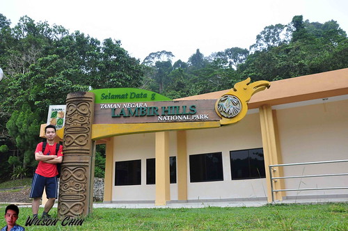
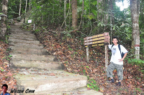
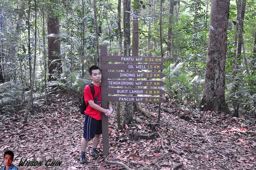
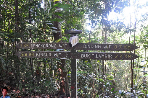
We started our journey at around 7.15AM from Miri town, and it took us nearly ½ hour drive to reach the Lambir National Park. We paid RM10 each for the entrance fees, and off we go. Here I would like to highlight about the entrance, there are two. One it’s at the back of the hostel (1.5 KM to a checkpoint), and another one it’s at the main entrance at the front of the park HQ (2.2 KM to the same checkpoint).
The differences are 0.7 KM, but this can save you a roughly one hour of very tough walking distant. My brother and I don’t know about the short route, so we just ascend by using the main entrance.
The differences are 0.7 KM, but this can save you a roughly one hour of very tough walking distant. My brother and I don’t know about the short route, so we just ascend by using the main entrance.
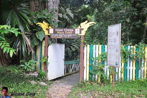
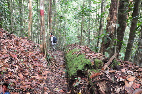
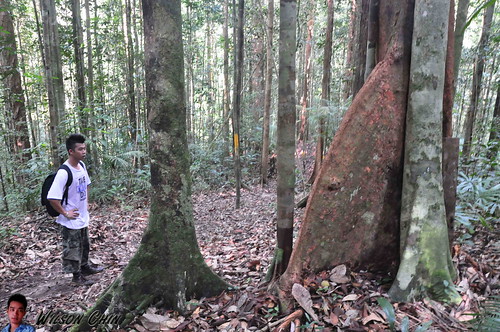
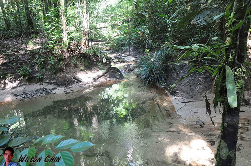
Upon entering, we’re welcome by a bridge, which link us to the other side of the hill. At first it was still an enjoyable walk, I lead and my brother follow. At the Lambir park, there are 7 - 8 recorded waterfall. Along the way there are also lots of small waterfalls which are not recorded in the map.
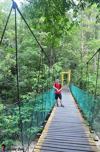
Then we reach a suspension bridge, and just not far from the suspension bridge we reach the first waterfall. We stop by for a while to take some photos and video, our goal is to reach the Lambir Mount summit. So off we go after a short break.
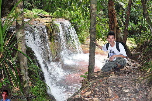
Along the way, we encounter two waterfall, they have no names. On the map they only marks as Waterfall 1, and Waterfall 2.
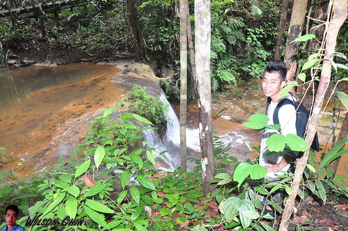
After that, we need to hike up on the concrete staircase, and then we reach another waterfall. There are no signboard on it, so not sure what is the name. Then, we pass the famous Latak Waterfall, to save time, we did not visit Latak waterfall. I told Jye that we just come back next time for this waterfall.
The Latak waterfall it’s the most visited waterfall in Lambir Park here, the water is clear, and cozy I can see why people like it here.
Jye are quite happy, as he keep on stopping and ask me to take picture of him on various wired stuff along our way.
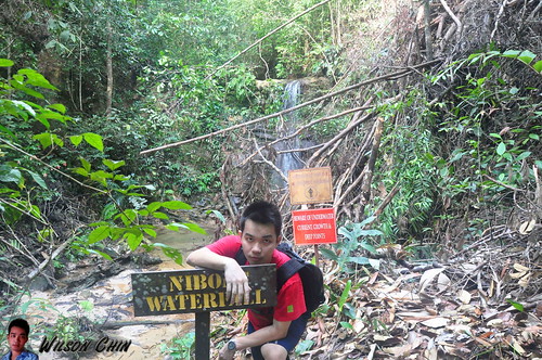
Till a wooden old bridge onward, we start to feel tired. We walk slowly to conserve our energy, and after 30 mins, we reach a junction one is to the Lambil mount, another one to the Nibong waterfall about 100m. We visited the Nibong waterfall, and took some picture, the trail to the waterfall are muddy.
On one of the stop we saw 3 park rangers repairing the damage rest stop. I asked them how far it is to reach the Lambir Mount summit, and the respond they gave are quite shocking! They advice us to hike the short trail which is to the Pantu Hill, roughly about 2 hour. If we were to go to Lambir Hill, it will take us around 5 – 6 hours.
Then I look at my brother, with my eyes open wide. 5 – 6 hours, are you kidding me??!! So they guys said if we hurry, we might be able to reach back the park HQ on time, which is around 6pm.
So we proceed on, I told Jye that we’re here for the highest mount, not some easy 2 hour Pantu Hill trail. If we miss out this chance, we’re not sure when will we come back here again.
We bid farewell to the rangers, they also wish us good luck, and asked us to be careful cause is been a while since there are people climb the Lambir mount, the trail now are in their worst condition, no maintenance work had been carry out for long time.
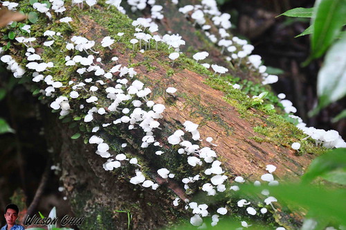
When we’re crossing an old wooden bridge, one of the handle was full of tinny white fungus. I told my brother that this can be eaten, and he fell for it… what an idiot K
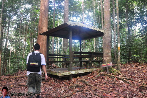
We’re been walking for almost an hour, and was really tired. Luckily we reach a rest stop. We quickly sit down and rest. We can't drink too much, because both of us just bring one a liter water each.
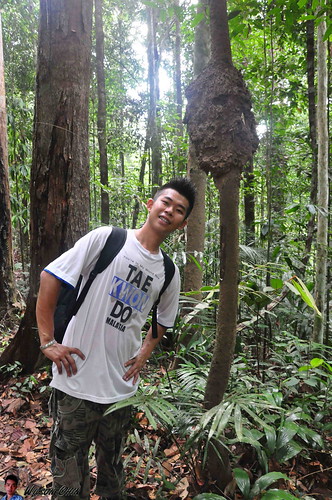
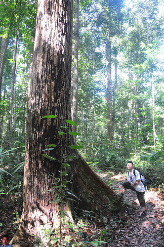
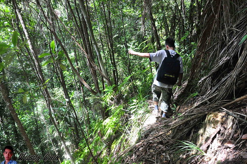
I keep track of our time tightly, so we just took a short 5 minutes rest to catch our breath. And off we go again. Along the way, I start to explain to Jye on the various flora that we encounter.
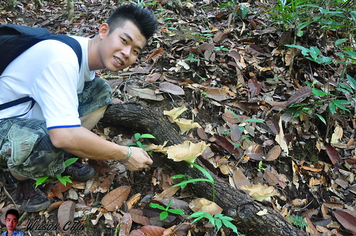
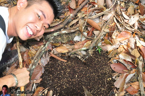
We saw this brown fungus, and on the top it carries some water. I use my finger to dip on the water, and pretend that I link my finger to taste the water. Then I told Jye to try it too, that stupid kid actually fell for it again. K
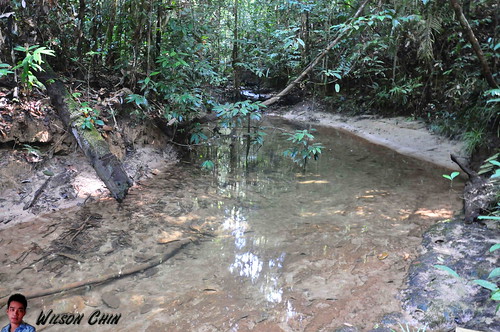
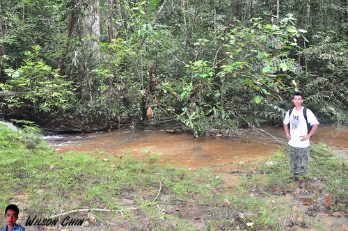
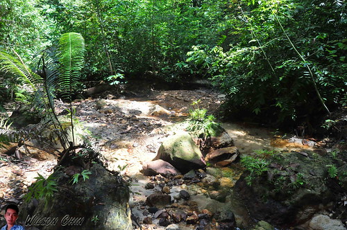
Dear readers, here I would like to informed you that to reach to the summit of the Lambir Mount. You need to cross three river like this with no Bridge!!! Yeah, no bridge. You can either take off your sport shoes, or like us we cross by using the falling tree branch (watch my video on how we cross the river).
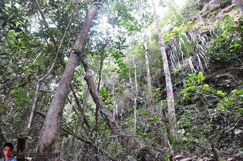
There are paint indication on the trees opposite the river, so that's where we need to go. We only notice this after scouting the place several minutes. Jye lead the way, at first there are two tree branches, when Jye try to cross the first one, it broke into half. And all the ants inside the branch fell into the water, then we saw the fishes start to swim near the falling branch, and eat the ants.
Jye tried again by using the second one, and he’s able to do so. But need to be very careful, the branch are slippery, we might fall into the river if we lost our balance.
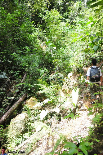
Off we go again!!! We have been on the trail for 3 hours. In our mind, we only wish that we can reach the summit fast. We also lost count on how many hill that we climb, and how many have we descend.
This is another river which don’t have any bridge. The trail are poorly maintain, I would say no maintenance at all. When we reach here, its very difficult for us to find where to next??!! So it took us quite some time to look for the next tree marking for direction.
I couldn't tell you how happy we are when we saw this. It proved that we are on the right trail, and in the same time it also tell us that we still have 2.2KM to go….. so far we’ve been hiking for almost three hours. We only dare to drink a small amount of water each time we rest.
Jye told me that he’s hungry, I replied him that we cannot eat the food yet. Cause we bring sausage, fried chicken, and more sausages. All these food are salty, and it will only make him thirstier. Frankly speaking, I also didn’t expect this, I only tough that it will be a walk in the park, so this time I did not bring any sweets, chocolate, energy drinks, or extra drinking water.
And then we saw these giant ant nets. I told Jye, ants have high protein, so if he is hungry, he can eat the ants first.. tsk tsk…
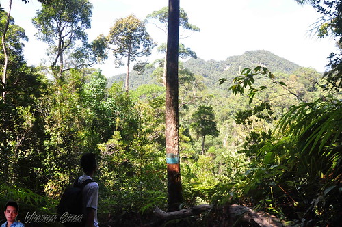
Look at this picture; we are not looking at the tree in front of us. But we are looking at the mount far in front of us. That’s where we are going, and that’s still a longgggggg way to go. Now I start to ask Jye why do we paid money to come here to suffer…hahaha :D
The time now is 11.30am. we still very far away from the summit, and I’m start to get worry that we might don’t have enough time to descend. Here is another place which have no clear direction marking. We have spend quite some time here looking around for the marking on the trees. And we’re just going circle in that area.
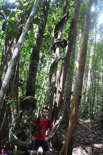
I remember when I hike the Rayu Trail at Matang, I also saw this kind of tree too. And the way that it circle the tree are more or less the same.
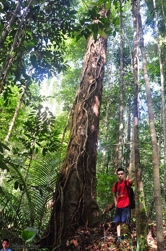
From this point onward, it starts to get really tough. There are lots of steep wall to climb, some we even need to use the rope to help us climb up. I am really tired, barely can walk another step again. But I want to reach the summit, so I did what I normally do when I’m tired, just force myself to walk one step forward, follow by another, then another…. with very slow speed. This actually works, remember your goal in the first place, and never turn back.
The trail are … well I would say that it don’t have any clear path to walk. The trees and grass has cover the trail, and its really hard for us to walk. There are very sharp leaves along the way, we don’t have knife with us. I blame this to Jye, as I already remind him so many time to bring the knife, but in the end he still forgot.
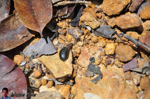
Yeah, wet and humid place like this with almost no pollution, there will be this cute little thing. The leeches!!! I got a few bites on my ankle, and toe. Same goes to Jye, and this is his first time got bitten by leeches, so its quite a good experience for him. Look at this fat leeches, sucking Jye's blood, now with a fat belly.
I constantly ask him to check on his shoes, to make sure that no leech trap on his feet, and mine too.
I got so tires, that I cannot take any more pictures, the both of us just walk up, we also stop talking to each other for about 45 mintues, so there are a 45 minutes of photos gap. I have no more energy to lift my bulky Nikon, and took picture, or make any video.
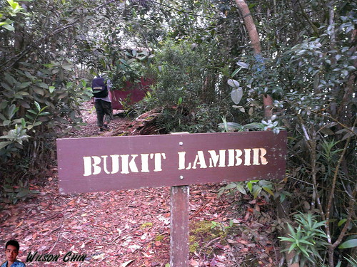
The time now its 12.40pm, and we finally saw this sign saying “Bukit Lambir” (Lambir Mount). Its been near to 5 hours from the park HQ this morning, and we finally made it!!! hurray!!!
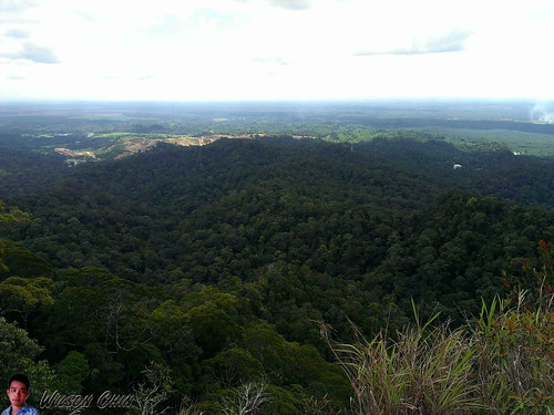
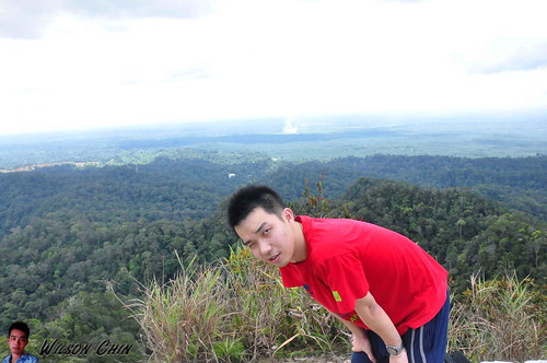
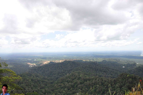
The view on the very top of the Mount Lambir, this is what we come here for! This is what we want! This is it!
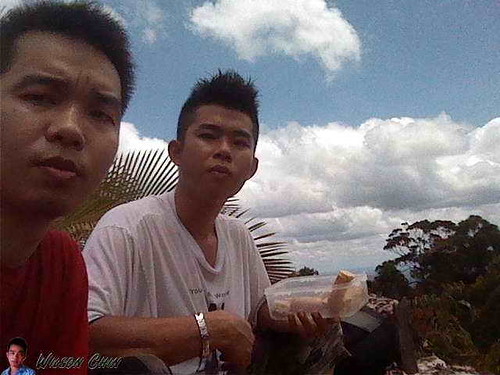
Me and Jye and the Lambir Summit as our background, Jye got so hungry I ask him to eat my share of the lunch.
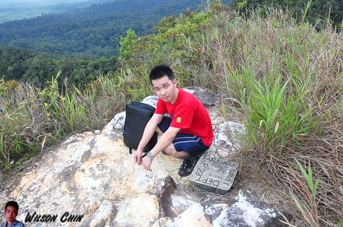
Its very windy up there, on the summit, there is a concrete mark state that this mount had been measure by the Sarawak Survey Department. I’m so happy that the sky is clear, I took a lot of panoramic picture on top. And I made it!!!
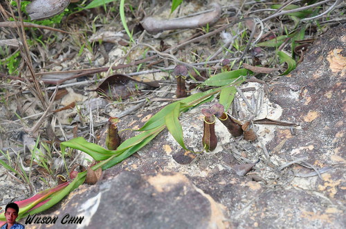
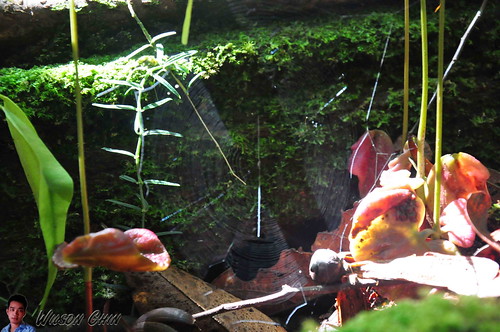
The usual plants that I saw on the summit are pitcher plant. I can say almost every mount summit that I’ve been to, there are pitcher plants there. And here at Lambir, they have the mini pitcher plant.
========================
After the Climb
So there you have it my friend, the story of me and my younger brother Jye concurring the Lambir Mount. We use 5 hours to reach to the top, and when we descend, we have to go through the thing we encounter before.
We also finished our water, and I just drank the water on the stream, cause I saw its clear. Jye also do it when he saw me drinking it.
The feeling when descending, is that I cannot feel my legs at all and I even feel tired when walk on flat surface. We walk very very slow, and took a lot of rest every 10 to 15 mins.
We manage to reach the park HQ at around 5pm, and the first thing that we do its buy two 1.5 liter of water at the canteen and finish it off in one go.
The next day, and the day after that both of our legs are still pain. It took us almost 4 days to recover. But we’re glad that we reach the summit.
=========================
Facts about Lambir National Park
Lambir Hills National Park is 30 kilometres (19 mi) south of Miri in Sarawak, Malaysia, on the island of Borneo. It is a small park, at 6,952 hectares (17,180 acres), and is composed largely of mixed dipterocarp forest, with some small areas of 'kerangas' (heath forest). The park is 150–465 m (490–1,526 ft) above sea level.
Lambir Hills National Park is probably the world’s most complex and diverse forest eco-system. Experts have found what appears to be the greatest level of plant biodiversity on the planet. It is not only plant life that is diverse and plentiful at Lambir - 237 different species of birds (at the last count), flying squirrels, wild pigs, gibbons, many different types of monkey, various species of deer, and untold insects and other invertebrates, all combine to create Lambir’s rich biological kaleidoscope.
Name: 03/02/2013 8:05am
Activity type: off trail hiking
Description: Mount Lambir
Total distance: 10.97 km (6.8 mi)
Total time: 4:53:42
Moving time: 3:56:05
Average speed: 2.53 km/h (1.6 mi/h)
Average moving speed: 2.79 km/h (1.7 mi/h)
Max speed: 11.70 km/h (7.3 mi/h)
Average pace: 23.76 min/km (38.2 min/mi)
Average moving pace: 21.52 min/km (34.6 min/mi)
Fastest pace: 5.13 min/km (8.3 min/mi)
Max elevation: 489 m (1604 ft)
Min elevation: 74 m (244 ft)
Elevation gain: 755 m (2478 ft)
Max grade: 40 %
Min grade: -5 %
Recorded: 03/02/2013 8:05am
Cheers,
Wilson
I reach Lambir Mount Summit!!!
1 comment:
Your blog is just so informative. Are you planning to travel there again? If you are here is a website that I do recommend to check out:
http://www.facebook.com/MASwings
Post a Comment