Blog Archive

Protected Mangrove National Park | Canoe at the Limpaki Wetlands Limbang, Sarawak

Limpaki is located close to Kampung Limpaki and about 15 km away from Limbang town.. Limpaki wetland is an estuarine wetlands where the Limpaki river meets the sea thus creating a mangrove swamp. The mangrove forest is inhabited by mammals (proboscis monkey), snake (cat snake), reptile (crocodile), amphibian, birds (owl), and insects (firefly). Its river teems with fish, prawn, crab and clam. It also has many species of mangrove plants.

One of the best ways to absorb and enjoy the Limpaki mangrove forest is via canoeing. Unlike cruising by motor-boat, paddling does not make loud noise to scare away the wildlife and it is a good way to work out and be up close to nature.

Clive Lim showing some of the attraction which we may encounter when we paddling along the riverbank.
The place where we start to paddle our canoe, at the Kampung Limpaki. We unload the canoe into the riverbank, and need to walk on the muddy bank into our canoe, so get ready for some mud on your feet. 
That morning the water are shallow, as it was still low tide, I can see the river bed easily. With some small fishes swimming around.


Beside wildlife watching  we can also experience other activities such as to fishing and crab catching. But we didn't try it, so we just canoe where the river takes us.
 I'm worry of sunburn, so have to cover up my face, and my arms.
Two local villages just came back from fishing, they are on a motorboat
 Full of mangrove along the riverbank

A signboard indicates that this area is a protected national park, therefore no hunting, no chopping down the mangrove trees.
The weather was too warm until I have to take off my life jacket, I know how to swim, so I guess its ok to do so.


Slowly paddling into a bigger river, and this river will eventually lead all the way to the Limbang/Brunei border, and we can paddle into the Brunei territory, but that's illegal trespassing, not recommended.

 After that, we slowly paddling where we started, back to Kampung Limpaki.

And now the water level had raises, the muddy water makes it impossible to see underneath the riverbed.
  A fisherman showed us his catch, he spend a night at the river. 
That's the end of our trip, overall its was a fun trip, I highly recommend you go for it when your at Limbang. Till next time, see you in my next post.


GUIDE CONTACT
Mobile : +60 13 844 3861 (Mr Clive Lim)
Email : walktomulu@yahoo.com.my
Website : www.walk2mulu.com


Total Distance: 3.06 km
Time: 1h
Min Altitude: 9 m
Max Altitude: 12 m

Your Hiking Guide to Bukit Kasut at Niah National Park

On year 1958 Niah Caves was gazetted as National Historic Monument, followed by 1974 the limestone outcrop and forest margin of Gunung Subis was gazetted as Nial National Park, this is the oldest national park in Sarawak, and the smallest at 3,130 ha. 

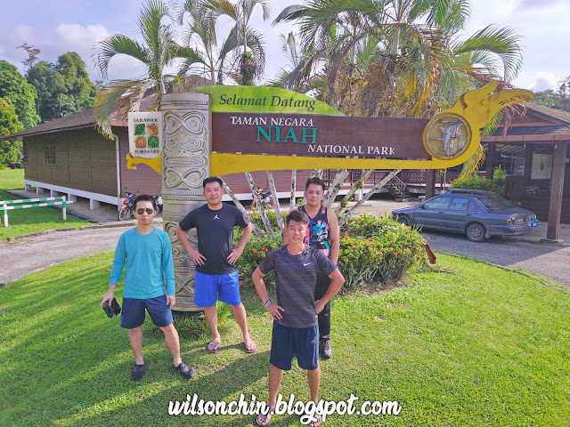
This is a write-up of my trip together with my brothers hike up to Bukit Kasut situated at Niah National Park, and to show you some tips when hiking to Bukit Kasut.
The entrance to go into the park is RM10 for local Sarawakian, and in order to reach the trail head, we will need to use a boat, which cost RM2 back and forth for one person.
To go to the trail head, the boat ride its less than 1 min 😂 so its a good buisness for the boatman, as its run by a private company, not under the national park I think.
 The trail head is the same to go to Niah caves, just follow the path, there is only one starting point.
There will be a sign with an arrow pointing to the right, to Bukit Kasut. There are two trails first start with the Madu Trail, and then continue on with the Bukit Kasut Trail, with a total distance of 3KM one way.
 Happy to see that there are a lot of big trees around, thank goodness its protected by National Park.


The trail are mostly muddy, so get ready to have your shoes get covered by mud.


Beautiful limestone formation, to form this pattern I guess it must need millions of years of rain and sun to form it naturally? 

Some interesting fungus that I saw along the Madu trail.


From here onward, the trail is called Bukit Kasut trail, its all ascending. 


There are sharp rocks everywhere, and trail still remain muddy, have to be extra careful when doing the ascending and descending hike


There are a total of 5 ladders to reach to the view point, where the longest one are near the top, followed by a short one. 

Another type of mushroom I think, what interesting was it looks like a shell, but it actually its a flora, with the opening its connected to the ground, just like a root.


On the view point, with the Batu Niah town behind me
Time for some droning 😊


My legs are full of mosquito bites, remember to bring mosquito repellent spray before you hike that place.


Trail Details

Distance: 5.8km one way
Time: 3 hours
Min Altitude: 13m
Max Altitude: 207m