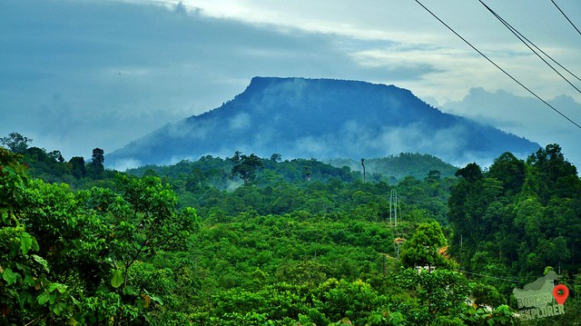
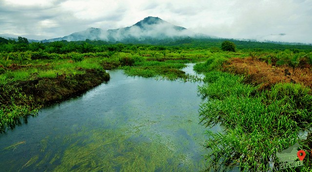
The mountain that we concur is called mount Lingga (the official name) or Gunung Lesong (the local name). Which is located at Pantu Town, read more about my post for my Visit to the Pantu town by click here.
It was a cloudy weekend, and drizzle occasionally, I woke up at 3.30am that morning. After freshen up I drove to meet up with the rest of my team.
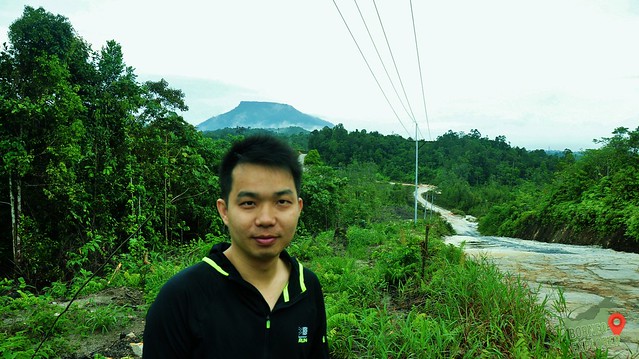
We had to depart early, because of the distance. From Kuching to Pantu Town about 127KM, 1 hour 30 min drive. And from the Pantu town to mount Lingga about 23km, another 2 hours drive.
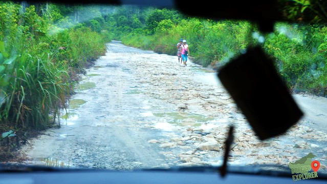
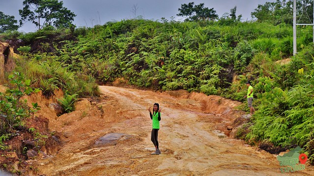
The road condition from Pantu town to mount Lingga was terrible. It’s the logging trail which use by the oil palm company. There are two village along the way, and they normally will use a 4WD or a motorbike to reach town. For those with no transportation, they just walk to town.
我与队友们登了位于板督镇的笼芽山(官方名称),乐宋山(当地名称)。点击此来阅读更多我拜访板督镇的故事。
我记得当天一直下毛毛雨,是个乌云密布的星期日。我凌晨三点半就得起身,洗刷完毕后赶紧去会我其他的队友。
由于路程遥远的关系,我们必需早出发。古晋到板督镇是一百二十七公里,大约一小时半的车程。然后板督镇到笼芽山是大概廿三公里路程,两小时的车程。
板督镇到笼芽山的路况非常糟糕,这是一条泥浆路,多数是巨型油棕罗里驾驶的路。这里有两座村庄,都是本地的依班人居住。要出到去板督镇就得用四轮驱动车,但是我还是有看见平常的私家车,而没汽车的人只好步行了。


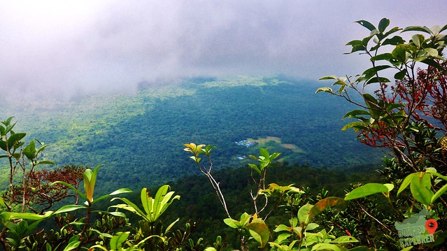
The view surround the mount Lingga is breathtaking, there are mist covering the mountain range and it’s not hot due to the cloudy weather.
不过我们一路上有说有笑,来舒缓我们紧张的心情。也欣赏我们四周围漂亮的风景。在我们眼前的山脉被雾覆盖着,太漂亮了。

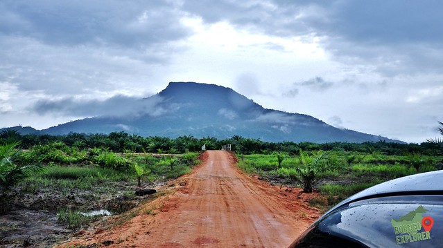
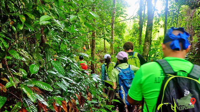
The road to mount Lingga is no joke, due to the bad road condition, and drizzling. It requires full concentration on every move. We are divided to two 4WD, I look back the 4WD behind us, notice the car rear wheels skipped several times on the muddy road, which worry me a lot, we have no experience on driving off-road. We have to drive very slow, and pray that nothing bad will happen to us.
当天的路程非常的危险,雨天,泥浆,坑洞,这些都是会引起反车的可能。所以我们的司机都步步为营,小心为妙。我翻过身看看跟在背后的四驱车,有几次看到后轮打滑,让我非常的担心。心中默念期望佛祖菩萨保佑我们的路程平安。


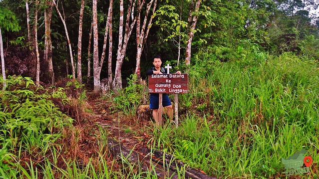
I felt relief when we reach the mountain base, the starting point has a Malay words signboard read “SELEMAT DATANG KE GUNUNG DOA BUKIT LINGGA” translate to English is Welcome to the prayer mountain, Mount Lingga. So obviously, this is a sacred mount for our Christian friends
当我们抵达笼芽山的起点时,我松了一口气。这里立了一面牌说“欢迎到笼芽山祈祷山”,也就是说这里是基督教徒的祷告地点。必需尊重这里的山草树木。

Photo credit: Lee Eik Ping


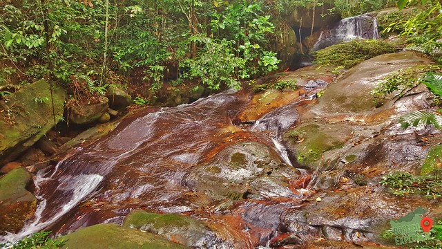
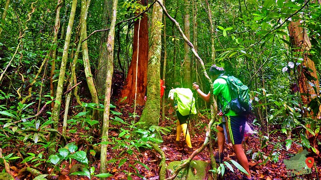
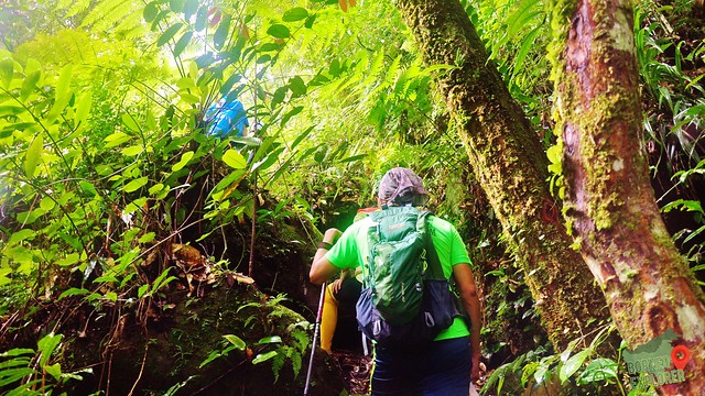
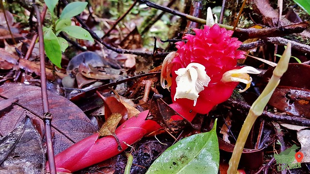
The trail to the summit was marked by red paint on the tree trunk, but must search for it carefully. Some of the marking are far apart from each other, and some had faded. There are few waterfalls along the way, the water is fantastic!!!
到山顶的路都有用红漆标记在树干上,不过有些标记已经模糊,不然就是距离远了一些,要小心的寻找。同时我们也看到有两三道瀑布,水很急,我很想跳进去游泳。

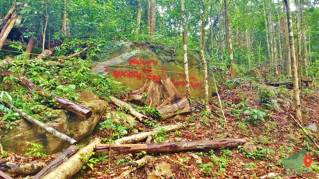
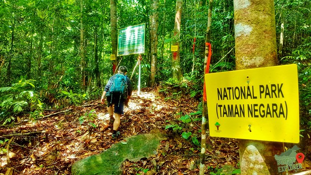
Halfway up the mountain, I saw a signboard erect by the Sarawak Forestry department. It reads “TAMAN NEGERA GUNUNG LESONG” translate to English is Mount Lesong National Park. Why is the name different? So according to a local friend who are from here, Lesong is the name called by the local folks here, where Lingga is the official name in the map.
在半山时,我发现这里有砂劳越森林部门立的牌,上面写着 “乐宋山国家公园”
这里根据我一位当地朋友的解说是“笼芽山”是官方的名字,而“乐宋山”是本地人叫这座山的名字。


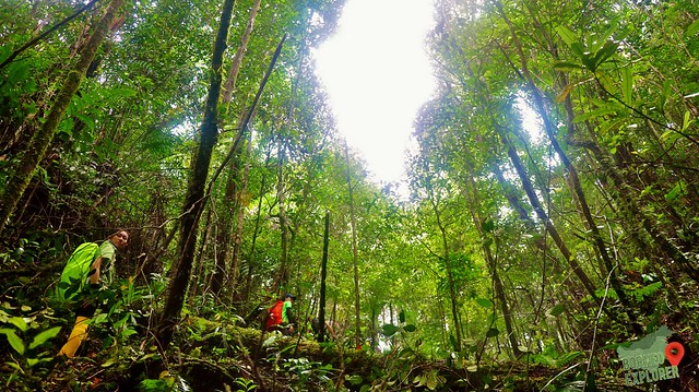
This mountain has a table top looking summit, the trail to summit is just ascent only. However, when we reach at about 800 meter above sea level, it was flat ground. At first we tough that this is the summit, the team is a bit disappointed, because we are surrounded by trees only with no view.
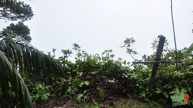
But I manage to spot another marking on one of the tree trunk pointing to right, we proceed on with our journey and as we reach 900m ASL, we saw a cross on the edge of the cliff and we know that this is the summit view point.
笼芽的山顶看来像桌子,是平面的。我们一路都是往上爬,斜坡一大堆!当我们来到海拔八百米后,很像已经没有前路了,大伙都认为这里就是顶峰了吧。我们有点失望,因为这里都是被树林包围着,没有任何的山顶观点。
幸运的是被我的金睛火眼看到不远处有一颗树干仿佛有标记,我们就继续跟着标记走。当到达海拔九百米后,看见在悬崖边立了一个十字架,着就是最高点了。我们终于到达目的地了!

I only manage to capture a portion of the view on base hill, not long after that all are covered by fog. We stayed there for about 15 mins for food, and start descend down.
在山顶,我只有拍照到山脚下一部分村庄的景象。因为都被雾盖着,什么都看不见。而且雾还越来越多。我们大概逗留十五分钟,吃了午餐后,就赶紧下山了。


Photos Credit: Lee Eik Ping
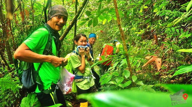
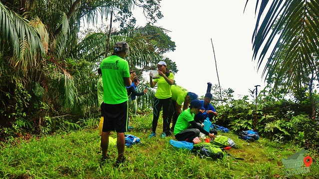
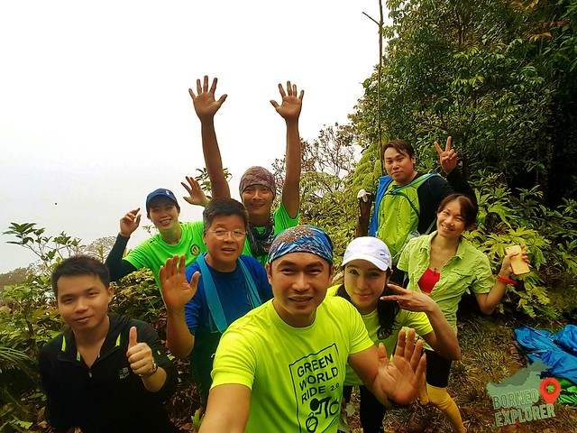
It was very challenging indeed, along the journey our team members have multiple leech bites, and a lot of sand-flies or flying insect bite us. And some of the path needs to use rope to climb further up, I am extremely tired but very satisfy.
这次的旅程非常的挑战,有些队友被山蛭咬,我们也被许多的小蚊虫叮咬。我的脚和手都是被咬的痕迹。有些比较斜的地方,也需要用绳子才能爬上去。虽然如此的狼狈,我还是因为攻到顶峰而满意。等下次有机会再来拜访多一次。


最后,山脚到山顶,接近六公里,三小时三十分钟。海拔:909公里
HOW TO GET THERE? 如何到达?
The only way is by Car
From Kuching to Pantu, 125km, for about 2 hours
唯一的方法就是用汽车
从古晋到板督,一百廿五公里,两小时车程
从古晋到板督,一百廿五公里,两小时车程
Then, turn into the Pantu junction to Town then to the base of the mountain, 23KM, for 2 hours
然后从板督镇的路口,到板督镇,再到笼芽山脚,共廿三公里,大概两小时车程。
然后从板督镇的路口,到板督镇,再到笼芽山脚,共廿三公里,大概两小时车程。
Lastly, form the base of the mountain to the summit, about 5.76km for 3hours 30mins
909 meter Above Sea Level
最后,山脚到山顶,接近六公里,三小时三十分钟。海拔:909公里


1 comment:
Wow!!What a beautiful mountain. But I don't know how to go to Pantu from Kuching Central.And I don't know where is Pantu.
Post a Comment