Blog Archive

10 Things You Can Do at the Mulu National Park


I've compile a list of the things you can do while your at Mulu National Park, and I hope to share it with you, so you can have an idea what should you do when your there. If your ready, let the adventure begins. 

The only way to go to Mulu is via Plane, MASwings is a regional airline which offer rural air service in Sarawak, Sabah. You can fly from Kuching, Miri or Kota Kinabalu

Access MASwings website here: https://www.maswings.com.my/

To land at Mulu, you need a bit of luck, if the weather is bad, you flight might not be able to land, and have to be route to other city.

Mulu has meets all the criteria to be a UNESCO World Heritage Site, which have an outstanding superlative natural phenomena and an area of exceptional natural beauty and aesthetic importance. 

1. Climb the 2nd highest mountain in Sarawak, Mount Mulu
Personally I think the Mount Mulu is the less promote places in the Mulu national park, I mean common, this is the 2nd highest mountain in Sarawak. The first thing I think about Mulu, its to climb this mountain.

To climb this mountain, you will need 4 days 3 night.

The distance its about 24km one way from park HQ to Summit.

The breakdown of distance is at follow:

  • Day1, Park HQ to Camp 3, 7 hours, 16km
  • Day 2, Camp 3 to Camp 4, 5 hours, 5.7km
  • Day 3, Camp 4 to Mt Mulu Summit, 3 hours, 2.3km

Also you can read my trail record on to climb Mount Mulu by click here.
More Info from the official Mount Mulu website here: THE SUMMIT

 Camp 1 - Pass by only, nice stream behind this hut
Camp 3 - Cold at night about 23 degree Celsius. Beware of leeches 🐍

Camp 4 - Cold at night, about 20 degree Celsius. Beware of leeches 🐍

Mount Mulu Summit Peak - Very cold about 13 degree Celsius.

View from the Mount Mulu Summit


2. Climb the Mulu Pinnacle at Gunung Api

The most talk about will be this, the Mulu Pinnacle. Many people said this was tough to climb, from my experience, I would said don't let that fool you, personally I think its easy to hike up, and you will need a bit more concentration during your descend. 

You will need 3 days 2 night for this trip

The distance its about 12km one way from Trail head (Kuala Litut) to Camp 5, and then to the Pinnacle view point.

The breakdown of distance is at follow:
Day 1, Trail head Kuala Litut to Camp 5, 2h20m, 9.7km
Day 2, Camp 5 to Pinnacle view point, 3h30m, 2.4km

Camp 5

Mini Pinnacle

Very windy up here, the wind came just in time to cool me down after all the sweating from this climb.
Pinnacle view point
3. Swim in the Melinau Paku river
To swim in the river its the one that I anticipate the most, I like swimming in the river very much, no mater where I go for my adventure, I would defiantly go for a dip if there is river nearby.


The perfect swimming pool to dip in for a swim after the long hike from the trail head to camp 5. Very relaxing, and the water current are rather strong at the middle of the river, so be careful if you are not a good swimmer, as you might be sweep away by the current to who knows where 😛


4. Visit the Penan Village
This is the Kampung Batu Bungan, a resettlemen village for the Panan people. We visited this place to buy some handcraft made by the Penan people. 


This granny knows how to blow the flute with her nose, how cool is that. 

5. Visit the Caves
One thing that not to be miss its going to be the caving adventure at Mulu National Park!

For normal cave visiting, you can go for:
Deer Cave, Lang Cave, Clearwater Cave, Cave of the Winds, and Fastlane.

For Intermediate level, you can visit:
Lagnang Cave, Racer Cave, Clearwater Cave Revival, or Eden valley walk

For Advance level, you can go for the:
Clearwater connection exploration, and the Sarawak chamber, which you will need to overnight at Camp 1


6. Watch the Bats Exodus
This is a show that not to be miss. Its the bats inside Deer Caves leaves the cave for food, they leave the cave on most evening in between 5.30pm to 6.30pm. For me its really a rare phenomena to be able to see it, expert estimate there are about 3 millions of bats exodus to consumes insects. That's really a lot!!! 😧

From the park HQ, you will need to walk about 3.8km one way on a plank walk, through the lush rainforest, about 45 mins to reach to the bats observatory area.


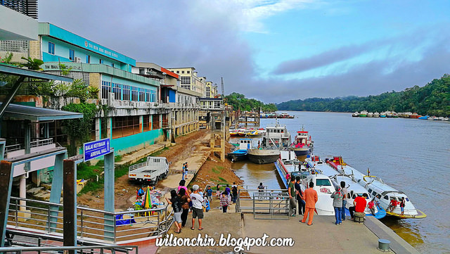
7. Enjoy the Awesome Boat Ride

I love my boat ride very much, I get to ride on the longboat to Kuala Litut, to the Clearwater cave, and even can use the boat the the Marriot Mulu Resort. Its a different experience when you use a boat to navigate from place to places. 

When there are no roads in the rural area, the river its the life line for human to connect to the outside world. And this is an experience that you can get when your at Mulu. 


8. Visit the Marriot Mulu Resort
When I visited this resort, all I can say is its beautiful! Would like to stay here next time with when I bring my children here for adventure.


9. Experience Cold Weather
 13 C


10. Forget about the time, embrace nature and have fun time with friends !!!


Camping at Pugu Beach Lundu Kuching

Pugu Beach situated at Lundu, after Pandan beach. Drive all the way up you will see road sign showing where is the beach location. Its a long stretch of beach, which lead all the way to the river mount of Sungai Sebako Besar.

My friends and I decided to visit the place, and stay at the resort hut which we paid RM50 per night.
Pugu Beach is about 7.11km long from bukit Gondol. The day I visited, was a hazy day. Partly due to the heavy burning on our neighboring country Kalimantan.

A panoramic view of the Pugu Beach, the view are very nice if you are at the top of the bukit Gondol. A small hill on the other end of the beach.

Enjoying the time hanging out with my buddies. Long time did not meet up with them, and camping together with them. Hope in future, we can have time to go for adventure together, just like old time.

This is a simple resort hut, they also have a toilet and washroom. But they don't sell food, so we have to bring our own food and water.

Kapit Town Exploration

My first time visit the Kapit town, and also the last town for me to complete to visit all the division in Sarawak. Kapit situated at the center of Sarawak, Borneo. And currently its accessible by boat, and by car, but the road condition are still not in a good shape as the time I write this post in Oct 2018. 
Therefore speed boats are still being use to go to the Kapit town. The earliest one starts at 5.45am from Sibu. 
The Rejang river its the life line for the Kapit town, all day to day usage are transport via ship by the Rejang river every single day.
There are many boats in all size dock at the Kapit wharf.
Also several floating gas station can be seen at the Rejang river.
Unloading supply, the lorry needs to go very close to the edge of the river bank. 
Not an easy job, but life still needs to go on.
Me in front of the Kapit district office
Most shop will close after 6pm, so its a bit difficult to find food after 6pm. There is one KFC, not sure what time they close.
Visiting Fort Sylvia. During my stay there, unfortunately it was a public holiday, so its not open. If not I would have visit inside the fort.
Opening Hours:
Tuesday to Sunday 10 - 12 noon & 2 - 5 pm
Closed on Monday and Public Holidays

To prevent further Iban migration upriver in the Rajang River basin, which was creating conflicts with the Orang Ulu, Rajah Charles Brooke built Baleh Fort at Nanga Balleh, the confluence of the Rejang and Baleh rivers between Kanowit and Song in late 1874. 

Rajah Charles Brooke nearly drowned here in 1877 when his boat capsized in the dangerous currents. He abandoned the fort in 1878, and replaced it with a new fort located lower down the river in 1880. The new Kapit Fort was built entirely of ‘belian’ (ironwood) timber with thick walls to withstand attacks.

On 16 November 1924, a peacekeeping ceremony between the Iban, Kayan, Kenyah and Kajang was held here in the presence of Rajah Charles Brooke. In 1925, Kapit Fort was renamed Fort Sylvia after Rani Sylvia Brooke. 

During the 1960s, the fort housed the District Office and the District Court House, and later the Resident’s Office when Kapit Division was formed in 1973.

source: History of Fort Sylvia (Wikipedia)
It even have a high water mark on the wall of the fort, from this can tell that flood issue in the 90s are rather serious. 
I visited several places in Sarawak with house in a man made pond, and the owner will name as name of house follow by the word Danau. I guess the word Danau means house surrounded with water.
Kapit is a small town, but its the biggest division in Sarawak, the district comprises 15,595.6 square kilometres. 

In future I will be coming here frequent as there are many unexplored mountain, one problem its that it is time consuming to reach, because of the poor road condition.