Blog Archive

Post 2 of 3 - The Mighty Julan | The Telang Usan Tableland Exploration

Because of my backpack weight issue, I did not bring my sleeping bag with me and I carry everything myself. First I don’t want to add weight to the porter, because the porters are already heavily laden with food, and their camping gear to support my team. Second I can also train my endurance to get stronger.

I can feel the chill breeze blowing toward my hammock, and the base feels so so cold. My socks are soggy, only one pair, can't use that for sleeping. So because of no sleeping bag, then I used my quick-dry tower as a blanket to warp both of my feet to keep them warm 😖

I did not have a proper sleep last night. checked the temperature is around 22'C so cold, just because of the rain.

Waited until 5.30 am, I then get off of my hammock, and it was still dark, and wet. I was thinking I should have gotten a cooker here so I can boil some water for a hot drink.


At 6 am, my guide is awake. They start to cut new firewood and cooked rice for our lunch later. I cooked two packs of instant noodles and drank a big mug of hot milo as breakfast.


Looking at the trail in front of me, it was where we came from yesterday and now it was all covered with fog. I hope no more rain today, please give us good weather.

My breakfast, curry Maggie instant noodles, and Milo hot drink


After my breakfast, I wear my hiking clothes, pants and socks. And starts to pack all my stuff into my backpack again. It is difficult to pack when the surrounding is wet. And I can feel my backpack is heavier than yesterday.

Spiders web and the morning dew

The 2nd-day trek covered an estimate of 6km, with 6 hours and 20 mins of moving time. We trek from the abandoned logging road, and then move into the jungle along the mountain range. 


In the jungle trail is where the leeches came and embrace me with open arms, or should I say open mouths. I have leech bite now and then, is it because they have never seen humans before, so it got so active? My belly, my arms, my neck, my tie, ankle, and feet (yes they penetrate over my socks), all have leech bites. I normally use the "minyak kapak" the ack oil to let them taste the power of the mint! 

While hiking, me and my team will check on our GPS devices to get an update on our current location. My guide on the other way used their instinct, their brain is the GPS. These hunters are so used to the jungle, they can easily recognize the marks in the jungle. 


At one point when I was following in behind, he stops and showed me the footprint of deer, wild boar, dead animal skulls, old markings from hunters, and animal dropping. Okay, I am impressed 😁


I remember when we hike to a point, we manage to get a glips of the western Julan waterfall. And can hear it roaring from a very far distance. I am extremely excited to be able to see western fall from far away, after all these years of thinking of her, wanted to meet with her face to face. Aduhh duhhhh... I just want to go meet up with her as soon as possible. It lifted my spirit that time, and I look back at my research team and motivate them for a while, then continue with our hike.


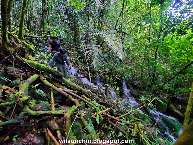
The route was a steady uphill hike along the ridge, it was very hard going through a tangle of fallen rotten trees, a big patch of fern vegetation, thorns plants and other delights of the jungle. I am constantly being attacked by leeches and horseflies to suck blood from me. However, this for me will be the joy of exploration, the experience I gain I will cherish forever, cause I am doing something that I have a passion for.

From this point onward, I can see more and more streams. My friend also stops to refill their water, and for a quick break. It is always very pleasing whenever I take off my heavy backpack on the ground and break for a while. This trail is like a never-ending trail, I can hear the waterfall sound getting loud and loader, and this also means we are nearer.


After hours of trekking, we finally reached Camp no.2 and without wasting any time, we put down our heavy loads and proceed to the western waterfall. This will be another 2 hours to get there. The weather doesn’t look good, I am praying inside me in hope that PuSa will bless me with good weather. But regardless good or bad, I must go!


The trail condition, now the surface has more loose rocks, muddy. Multiple streams flowing down. This side of the hill has so much more water compared to the one where we set up our camp no.1 with one wrong step, one might fall hard and get a serious injury. Even though I am eager to reach the western Julan waterfall, safety is still my priority. I constantly checking myself, but the damn leeches somehow still manage to find a way to bite me, errrrrrr.....is very annoying!!! 

The last stretch is a huge valley, full of mossy plants crawling all over the trees. The droplets of the waterfall make this into a mossy forest. Everywhere looks the same, it is not because of the roaring sound from the waterfall, it will be hard for me to get a sense of direction in this kind of jungle. The trail is muddy and slippery, with many big boulders that I need to carefully crawl over using my arms.


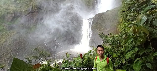
After two hours of hiking from camp no.2, we had finally reached the western Julan waterfall. There she is just right in front of me. After all these years of just reading books, looking at pictures, and watching clips on the internet. She is now in front of me!!! I can't express how happy I am, this feeling is simply amazing.


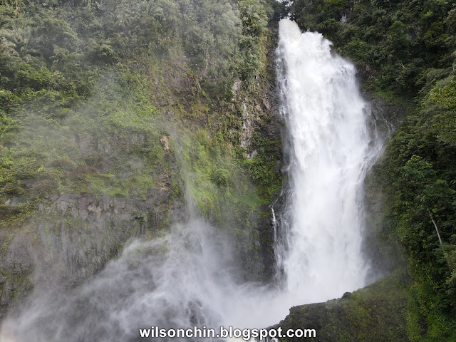
The size of the Western Julan waterfall is something I cannot imagine by just looking at pictures. It is huge, and the water that flows down from the top of the waterfall, when it gets impact into another tier, some of it becomes mist, the force is so strong that it created a force and blew the mist many meters away. I cannot believe what I witness with my own eyes in front of me. Why on earth can there be something so strong? The water is RANGING water, flowing constantly down the river!!!


A better scale on how big the waterfall is

 Slowly and steadily I descend to the base of the waterfall. The force of the breeze is extremely strong, I am constantly being blasted by water mist from the waterfall, it is really fun! I sat at one of the rocks, scoping the water to wash my face, woooowwww, it is really cold. And then I take off my rubber shoes, opss I found two leeches on the right and one more on the left. I then soak both of my feet in the water, what a good way to relax my leg muscle. After that, I keep on taking videos and photos of the waterfall to try to keep this memory.


I saw some of my friends and guide are still at the edge of the ridge, also slowly coming down to the waterfall base. We all had a wonderful time enjoying the strong breeze of water mist there.


The time then was about 4 pm, and I can hear my guide calling me time to go back to camp no.2 (2 hours) while still having daylight. Shit! I just remember I did not bring a headlight, and my mobile battery just left about 20%. Guess this is it... I slowly stand up, wear back my rubber shoes, and climb up.

Once I am in the jungle again, it was dark, one weather is not good, two the day was almost coming to an end. I then turn on my turbo 4WD mood and hike very fast I manage to catch up with the guide, and my friends, and reached camp no.2 first to set up my hammock.

That night, it did not rain. I went to the river nearby to clean up myself. My guide cooked dinner but I don’t know why I don’t feel hungry, so I skipped dinner that night (maybe too happy seeing the western Julan waterfall). My researcher friend also manages to get a lot of flora samples along the way and recorded them with his camera. He even showed me a red shell carb, it was a land crab. For me, I am glad to see that every one of us manages to achieve our objective.

Not long after our dinner, it starts to pour rain again :S This is not good, as our initial plan was to hike to the Eastern side of Usun Apau, and camp on top of the Eastern Julan waterfall. We will need to cross two rivers from the western and eastern Julan waterfall, but if heavy rain and the water level rise, it will be very dangerous for us to do so. Especially in the middle of the rainforest with dense vegetation.


That night is the same as the first night. I sleep for a while, awake, and sleep back again. Can't sleep properly, so I just keep on constantly checking on the fly sheet to make sure that it has no rainwater leak into my hammock. I also checked the temperature again, and it was around 20'C that night. Suddenly I felt something bite my toe, I quickly switch on my headlight again to check, and to no surprise, it was a stupid leech, and thanks to that fella my toe is now bleeding. So I have to crawl out from my hammock (while still raining) where is already so cold and look for my first aid to clean the wound and stop the bleeding. 

This is how day two of the exploration ends..

Telang Usan Tableland Exploration:
Post 1 of 3 - The Journey  
Post 2 of 3 - The Mighty Julan
Post 3 of 3 - The Millionaire Club

Post 1 of 3 - The Journey | The Telang Usan Tableland Exploration

The Usun Apau and Linau Balui proved that these two distinct volleys of volcanism were presented long ago. Other than an old volcanic site, the Usun Apau tableland also contains many mega waterfalls that spill over its rim on the edge of the tableland, and it is also believed to be the headwaters of the Barams and Pelagus-Rejang rivers.

On my hiking journey, I meet many people with the same interests as me. There is a senior of mine which equipped with rich knowledge of the flora fauna and geography of Sarawak. Told me about the highest waterfall of Sarawak, the Julan waterfall at the Usun Apau plateau, it is located in central Borneo. This immediately caught my attention, and I told myself that I must go and see it myself because is in Sarawak, my beautiful homeland.

I started to research about this place and stumbled upon two books one “Sarawak on the island of Borneo/Malaysia” Published at the year 1986 by Robert Hoebel, and written by Yeoh Siew Hoon on page 195, it briefly mentions the Usun Apau, Julan Waterfall. It says the landscape is spectacular, sheer cliffs plunge their way downwards, meeting the plush green carpet on the jungle floor. And then it attached one photo of Eastern Julan Waterfall, so beautiful.


And another one is "National Park of Sarawak" Publish in the year 2006 by Hans P.Hazebroek, and Abang Kashim bin Abang Morshidi, on page 255, it documents clearly the Geology, Climate, Soils, Flora and Fauna in that area.


In the Year 2017, I manage to pull up a team of Adventurers and venture into the lush jungle of the Usun Apau. I am 35 that year and have been hiking since primary school. Seen countless waterfalls over the years, but I have never seen anything like this.


In front of me was the Eastern Julan Waterfall, with a 100-meter single drop. The force of the water is so strong that when the water reached the base. It immediately becomes mist, thus when the sun’s rays shine on it, I can constantly see a few rainbows. I was stunned when I was at the base of the waterfall, the strong breeze current created from the water drop from high up constantly blowing at me, and I am all wet even without going into the water. 
At that time, I feel alive, I feel amazing, and I feel small standing beside this giant.

After finishing the trip, I already plan for a 2nd exploration back to Usun Apau again. This time is to the western side of the plateau to visit the Western Julan Waterfall.

According to the map topology, this waterfall is about 350 meters high. It is 3 times the size of Eastern Julan Waterfall. I was thinking, the eastern Julan waterfall is already amazing, what will it look like if one day I can be at the base of the western Julan waterfall?

5 years later in the year 2022, I finally get the chance to revisit Usun Apau, and this time is to the western Julan waterfall. I lead a team of 2 local researchers and also 1 local guide and 3 porters to set off on a four days exploration to try to reach the western Julan waterfall.


We reached Miri one day earlier, and the next morning we meet up with my guide. The drive from Miri to the start of the trailhead took us around 125km and 6 hours of 4WD car ride via the muddy logging road.


Without wasting any time, I change to my hiking wear and double-check my backpack to make sure that I have everything in it. 


On this trip I packed several things:

·        A 35 litter hiking backpack, rain cover

·        Hammock and Flysheet

·        2 sets of clothes for hiking, 1 set of clothes for sleeping

·        3 litters of drinking water, a filter, and a box of chlorine tablet pills

·        A small cooking pot, and spoon.

·        A camera, a smartphone, a drone, and 3 power bank

·        Three 10 litter dry bags to waterproof all the items above


I am expecting the trail condition to be similar to the eastern trail. I am wearing a pair of rubber shoes to get ready for mud, and river crossing, and it also has a good grip on the wet surface. The only drawdown is that if I hike for a long period (more than 10 hours) with that shoes, it will injure my toe and destroy my toenails.


The trail starts with the abandoned logging trail, with long ferns and mimosa pudica.

Day 1 is to hike to our camp no.1 and the distance is around 8.7km with a total time of 4h 30m.

We start with 432 meters above sea level till 644 meters above sea level.

The thorn from the mimosa is extremely annoying. I have to stop every once in a while to check on my socks and pull out the thorn.


Normally I will hike by wearing short pants (same during my eastern Julan waterfall hike back then) but this time I am so glad that I made the decision to use long pants last mins. If not my legs will be badly scratched by the thorn from the plants on both sides of the trail. The fern is as tall as a person, and mimosas are all over the fern, I have scratched on my arms, neck, shoulder, and a bit on my face. A terrible experience.


It was a hot day, hiking under the big hot sun with thorn plants on both sides. It is not a good way to start. I checked on my team the two researchers, they didn't talk much but just followed my lead. I am glad that they can still take it.

To make things worse, no water source is easy to get. It is either too deep down the ridge, or dry (currently is dry season). I still have water, but my two researcher's water is almost finished. I told my guide that we need to quickly find water for them before they get dehydration.

Not long after that, my guide manages to find a water source. While we stop for rest, he hikes a few meters descend and took a left turn into the jungle valley. After that, he called for me to refill our water there. Interestingly, the water came out from a rotten log, crystal clear water, and also cold. The porter team fill up the bottle with water for cooking later, and the 3 of us also refill ours.


The most exciting part of being able to have a glim of the Western Julan Waterfall from far away, I already can hear the roaring sound of the water pouring down from the waterfall. It is really amazing!!!

The time is around 6 pm, and we finally reached camp no.1 this is where we will stay for that night before continuing the hike.


Immediately I told my team to set up their hammock and flysheet, Based on my experience when you reach your campsite, this is the first thing you will need to do, in case it rain, you will still have a shelter.

My porter team, are hunters, they cut down small trees to build their shelter in a local style with a raised sleeping platform made from logs, for the roof they used tarpaulin canvas. And also cut the tree log into firewood for cooking.

For our food, during hiking, my guide collect the young grown fern (the soft one at the tip) and put it in the plastic bag, he told me that this is our meal for dinner later.

Not long after we finished setting up our hammock and flysheet, it starts to rain. My team of researchers does not have much experience in setting up a hammock, and I helped out and did some minor adjustments to it to make sure that the flysheet will not end up hoarding rainwater and collapse.

There is no water nearby so on day 1 there is no bath for all of us. No more daylight after 6 pm, plus the heavy downpour, we can only squad under the flysheet chit-chatting about our trip so far while waiting for our dinner.


Not long after that, my guide called and dinner is ready. For dinner, we had tin food, salai (fern cooked with chilli, onion, and salt), dry chilli anchovies, and dry tapioca leaf with white rice. Super delicious, especially the fern.

We had a splendid meal inside the jungle, I like the young fern very much, super yummy. And I applaud my guide for preparing that meal for all of us, and he looks happy. After dinner, it was still raining. We all head back to our hammocks and rest. For me I didn't manage to have a good night’s sleep, because it was too cold for me, I check the temperature is around 22'C

I can stand humid hot weather, but I surrender when it comes to cold weather. I had a terrible experience in the highland jungle of Borneo due to cold weather 😓

So the whole night I sleep for a while, and awakes, and sleep back and wakes up again. And constantly checked on my flysheet to make sure that it does not leak, when the rain gets heavier, it also worries me more.

This is how day one of the exploration ends...

Telang Usan Tableland Exploration:
Post 1 of 3 - The Journey  
Post 2 of 3 - The Mighty Julan
Post 3 of 3 - The Millionaire Club

Exploration to Mount Sadung at Serian Sarawak


I would like to share my experience in exploring Mount Sadong at Serian Sarawak. The journey up to the summit was not as hard as I thought it would be because the trekking trail is not too difficult but is rather steep so take extra care when walking on slippery surfaces around each turn of corner throughout your climb up.

My friend and I were all meeting at the parking space near the coffee shop at 13th mile as early as 6.30 am, we all had our breakfast, some of us had our kolo mee while some others had our kuih tiao and a cup of coffee to energise ourselves. 

As we drove off, I look outside the car window and can see the sunrise, it was so peaceful and beautiful with no clouds in the sky. We arrived at Mount Sadung at around 8:00am . The view from Mount Sadung was spectacular, even though there were some clouds coming in but they didn’t stop us from having fun!

We arrived at Kg Sadung village at 8.10am and parked our car near the school. Then we also check that we have all the necessary things needed for the hike, and gear up by changing our hiking boots and clothes. We started our journey to the summit of Serian`s highest mountain peak at 8.20am.


We started hiking at 8am and it was a 5.2km round trip hike with some steep climbs in between. The hike is a challenging one but it is a good way to get some exercise and fresh air at Mount Sadung.

The trail is mostly steep with very loose stones and some big boulders. There are some steep steps on your way up to the summit which may require short rest stops before proceeding higher. Some ropes are fixed at the extremely steep area to help hikers to climb up. The distance from the base camp to the summit is about 2.6 kilometres away with an elevation gain of 720 meters above sea level. It takes about 2 hours and 20 minutes for us to reach its peak from base camp but it depends on how fast you can walk or jog yourself up as well as how much effort you put in during this hike!


As we reached about an hour into our journey up Mount Sadung, we started seeing more mushrooms around us. There were also many other kinds of plants that I did not know what they were called at that time.

After about an hour or so, the trail started to get steeper and many sections were covered with thick forest vegetation. You could see some beautiful views along the way as well!


The trekking trail is not too difficult but is rather steep and slippery due to the muddy ground with some fallen trees across it. But nevertheless, I enjoyed every moment taken during my ascent as there were so many flora and fauna awaiting me around each turn of corner throughout my climb up.

The trail is marked with red paint at the tree trunk, so you will not get lost along your way. Sometimes it may be muddy that you need to hold onto a branch or tree root to avoid slipping on them while walking along the path.


As soon as I reached halfway through my journey, I was surprised by what I saw— a small waterfall, a few trees have fallen across the path! But these trees are quite big and thick, making them quite difficult to move around. Here are mostly sandstone, and there is also a section with a landslide careful not to get lost in this area as it can be dangerous!.


Conclusion

After spending about 2 hours reaching the top, I was very excited and happy to be there. The view from the summit of Mount Sadung is breathtaking with a 360° panoramic view of Serian town, Pan Borneo highway, and Gunung Ampungan. It also gives you an opportunity to see a variety of flora and fauna including pitcher plants, as well as butterflies flying around freely around them along with some birds (falcons) flying above our heads too!

Maps

Distance: 2.6km one way

Time: 2 hrs 20mins

My 2019 Hike to Mount Sadung, Serian read it here.