The Santubong National Park is a good place to explore and seek for adventure, it is a hidden gen waiting to be rediscover again by me. I joined my hiker friend Ian Vong (he own the site My Santubong & Borneo Adventure) to the Santubong lighthouse, which is situated at the tip of the Santubong peninsular.
山都望国家公园,一个探索的好去处。我与一位登山友一起到了山都望,务必要到 SIPANG 海角的灯塔探索探索。


山都望国家公园,一个探索的好去处。我与一位登山友一起到了山都望,务必要到 SIPANG 海角的灯塔探索探索。
7.30am - We start to hike from the Permai Rainforest Resort, this will be the west coast of the Santubong peninsular. Watch my previous hike to west coast here.
早上七点半,开始从 PERMAI 出发。这次我们是走西部到灯塔,我上一次走过的记录在此点击阅读。
8.00am - Its an easy trek so far, the trail are clearly marked. The weather are super fine that morning, the sun was covered by clouds. We are hiking next to the coastal line, due to the constant breeze, the wave are big that day.
早上八点。路线还蛮轻松的,没有大起大落。天气又好,没有下雨。海风有大,我们走靠近海岸,当天的浪很大。
8.20am - Stop by at a small bay for a short break. And to take some aerial footage. That area are full of plastic waste, all being wash on shore. Its a tragedy to witness this.
早上八点廿分。来到一个海湾,有一个小小的沙滩。风景很漂亮,但是遗憾的是塑料废物一大堆,都被冲上岸来。
This small bay are beautiful, with fresh water flowing from the jungle, and beautiful rocks all over the place. However are the shore it was all covered by plastic waste.
这里有小溪流,漂亮的岩石。美中不足,就是这些塑料废物。我们在次小休,飞无人机摄影。
Some part of the trail require us to walk on the coastal line, the wave are bigger than usual that day. So far my shoes are still dry 😏
有几段路线是要走到海岸边,然后那些大浪就会打上岸边。不过好在我的鞋目前还是干的。
8.45am - Walking on the coastal like is to walk on the big rocks, there are very little sandy beach there at Santubong.
早上八点四十五分。海岸线多数是石头,有大有小。很少见到沙沙的海滩。
9.17am - The roots of the tree grows on the surface of this big rock, imagine how long it takes for the roots to grow there. Nature is amazing.
早上九点十七分。看这粒大石头,都被树根慢慢的包围着。树根好厉害,可以深入泥土,也可以粘在坚硬的石头上。大自然的力量。
On the west coast there are a lot of plantation with thorns, spines.
我最最最讨厌的这些荆棘植物,我的衣服就这样完蛋,不时都会勾到这些植物,弄破我的衣服。
9.33am - At Santubong there are many streams big and small. The water are clear, when your on a long trek in Santubong, no need to worry much about drinking water, there are plenty of mineral water here to drink.
早上九点半。山都望到处都是溪流,来这里探险不怕没有水喝。
10am - The wave are still very strong, our initial planning was is its low tide, we can hike along the coastal on the beach where its more easy and faster.
早上十点。我们本来计划是希望是退潮,这一来就可以走在海边,比较快。但是当天的浪很大,而且水位都是一直处于高涨的状态。没办法只好走进森林。
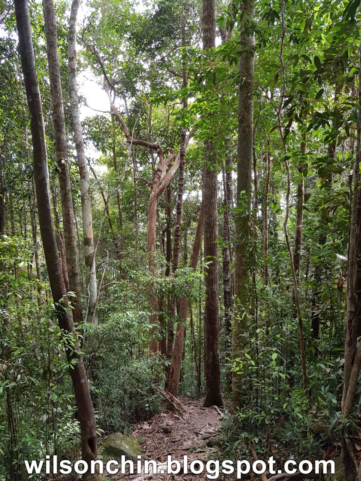
10.24am - For me so far the trail are still easy to hike, and many nice scenery to see along the way.
早上十点半。目前为止路程都还蛮轻松,又有漂亮风景观赏。不错!!!
10.44am - The trail lead to the beach, on the west coast the beach are all rocks.
早上十点四十四分。要绕道海岸边继续。
Some of the rocks are very slippery, I dont want to get injury here, have to pay extra careful when walking on the rocks, good thing I wear the correct shoes today.
有些石头很滑,我不想在这里受伤。无时无刻都很小心的走着下一步。
11.04am - Reach the abandon houses which locate somewhere at the neck of the peninsular. We had our lunch, and a few minutes break. I drone for a while here, and you can checkout my video here.
Unfortunately after this point onward, I did not manage to take anymore photos, because my camera had contact with the sea water while navigating along the rocks 😱 I can't turn on my camera, my Nikon D90. Feel very sad.... should get a waterproof camera next.
早上11点。到了山都望半岛的颈部,这里有几件荒废的小木屋。我们在这里午餐,休息。飞一飞无人机,拍照。
过了这里,我的相机不小心被海水弄湿。无法操作,好心痛阿~我的尼康相机 📷 希望可以修理好。
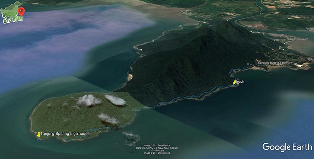
2.38pm - After about 7 hours, we manage to reach the lighthouse. Its a solar power lighthouse. I'm so happy that I made it here.
下午两点半。经过七个小时的徒步,终于到达目的地。这个是一个由太阳能运作的灯塔。
4.30pm - The lighthouse is situated at Tanjung Sipang, the wave are constantly hitting the coast shore. And by the time our boat reach to pick us, we are had some trouble on getting from shore to the boat. Ian had tried to kayak to the boat a few time, but fail. At last he suggest that we hike east about 2 kilometer away to reach to a place where there are smaller wave for us to board the boat. But do you think that place is safe for us to get to our boat? check out my video here.
下午四点半。坐落在 SIPANG 海角的灯塔,这里的浪还是很大。我的朋友尝试用皮艇划到船,但是都不成功。一直被浪打回岸边,非常的危险。岸边有很多石头,朋友们都受伤了。
最后,朋友建议再徒步前进大概两公里,到北部,希望哪里的浪安静些。
你觉得我们能够成功的登上我们的船,载我们回家吗?哪里的浪真的比较小吗?答案就在我的视频里。
Video of Tanjung Spitang Lighthouse Adventure
Trail State
Ascent: 92(67) m
Distance 9.22 kmMax Altitude: 110 mMin Altitude: 61 mAverage Pace: 44:00 min/kmAverage Moving Pace: 34:17 min/kmMoving Time: 5:16:17Stopped Time: 1:29:30Total Time: 6:45:47

 s
s