Blog Archive

The Miri Lutong Beach


View Larger Map

The Miri Lutong Beach, I went there with my brother one evening. Miri have a lots of public beach, and my brother told me that this is the most clean and prettiest among all. A lot of people will go there evening with friends and family, as I saw some people play kite, building sand castle, and swim. My brother and I also dive into the arms of the sea, and embrace the cold sea water. The sunsets at around 6.35pm, and we stop swimming and take time to enjoy the nice sunset view.

people play kite at beach

Miri Lutong Beach view

Miri, Lutong Beach Sunset

Get my Malaysia Passport, and I'm ready to go Home

I'll be on travel next month back to visit my parents. Haven't been home for 3 years, and I miss them so much. I'll be going to Brunei as well, so I need to renew my passport.
For a Malaysian passport the stuff that I need are:

1. Two Passport size portrait pictures
2. One photocopy of my Malaysia Identification Card.
3. RM100 bucks for a 48 pages two year passport.
4. Waiting time is 2 hours for me to get my passport once I made the payment.

With a Malaysia passport I can travel to almost any country expect Israel.

IMAG0026wtmk
I went to the Malaysia Immigration department, Sarawak Branch office. Morning around 8am. They build a new parking space for public.... this place exist before, just now they have enhance it with tarmac.

IMAG0024wtmk
I didn't know I need a photocopy of my Identification Card (should do my research before this), so I went to the photocopy shop down the office and paid a bloody expensive 20cents for just one copy of my IC. Come back to the office again to submit my application form.

IMAG0025wtmk
Then, I need to pay RM100 for my passport before they send my application for process.

IMAG0027wtmk
Then I went back again in the afternoon, get my number and collected my passport!! yeah, I'm ready to go home :)) xoxo

Different Types of Cruise Holidays

Every cruise operator and liner offers a different experience, whether it's the range of destinations you can visit, the onboard entertainment, the cuisine or the list of facilities. But the variety goes much further than that. Before you've even selected your perfect itinerary or chosen a ship, there are other considerations - such as do you prefer to fly or sail from the UK? How long do you want to travel for? Will you combine your cruise with a land-based stay? And so on.

Cruise holidays follow many different formats and even within the same operator, you'll find a fantastic range of choice.

So what are the main types of cruise holidays?

First off, fly cruise is one of the most popular formats. As the name suggests, you combine your cruise with return flights which means you save time on sailing from the UK, and it allows you to get to your first destination much more quickly. This in turn cuts down the amount of time you're at sea and means you can potentially visit more destinations within the time frame. And because of its popularity, you're likely to find plenty of fly cruise deals too, which helps to make your holiday a little easier on the pocket.

The other option is to sail from the UK. There are various reasons for this - partly it appeals to those who don't want to fly, which opens cruise holidays up to a wider audience. Also it helps to keeps the costs down which makes this style of cruising a little more competitive.

Then there arecruise and stay holidays. For those who want to make the most of their cruise and enjoy an extended holiday experience, this could be the perfect solution. With a cruise and stay, you'll combine your sea-based cruise itinerary with a stay in a land-based hotel. It can take a variety of different formats - for instance, you could have a straightforward week on a cruise followed by a further week in a hotel, staying in your final port of call. Or you could take a Caribbean cruise and, on the last day, fly to New York for a further few days in the city. It's your choice.

Which type of cruise holiday tickles your fancy?

Matang Kubah's Rayu Trail, Sarawak Rainforest Exploration


The details of my Rayu Trail

Created by My Tracks on Android.
Name: Rayu Trail to Matang Wildlife Center
Total distance: 6.29 km (3.9 mi)
Total time: 3:36:38
Average speed: 1.74 km/h (1.1 mi/h)
Average moving speed: 16.32 km/h (10.1 mi/h)
Max speed: 17.73 km/h (11.0 mi/h)
Average pace: 34.42 min/km (55.4 min/mi)
Average moving pace: 3.68 min/km (5.9 min/mi)
Fastest pace: 3.38 min/km (5.4 min/mi)
Max elevation: 394 m (1292 ft)
Min elevation: 26 m (87 ft)
Elevation gain: 2763 m (9066 ft)
Recorded: 17/09/2012 8:06am start, 11.42am ends.


Then lastly, enjoy the picture that I took during my trip. It was a fruitful day, as I can see different kinds of flora and fauna. Some highlight are a frog which is smaller than my finger, an iguana blending its body colour on the tree trunk, huge rattan next to the tree, and the feather of wild bird.

matang_kuching_0001matang_kuching_0002matang_kuching_0003matang_kuching_0004matang_kuching_0005matang_kuching_0006
matang_kuching_0007matang_kuching_0008matang_kuching_0009matang_kuching_0010matang_kuching_0011matang_kuching_0012
matang_kuching_0013matang_kuching_0014matang_kuching_0015matang_kuching_0016matang_kuching_0017matang_kuching_0018
matang_kuching_0019matang_kuching_0020matang_kuching_0021matang_kuching_0022matang_kuching_0023matang_kuching_0024

Trip to Silabur Cave, Tebakang, Serian, Kuching


I was invited by a group of close friends for a trip to a cave at Tebakang, Serian. The name of the cave is called The Silabur Cave (Gua Silabur). Tebakang, is a place with striking limestone hills with vertical cliffs.


Start our trip at 7am in the morning, after an hour drive we reach a place called Tebakang at Serian. I haven’t been here for more than 10 years, I remember one of my uncle had an omni shop here, and each time when we’re at Kuching we will drove here and visit him. Tebakang is a place with just one row of wooden shop houses. And opposite the shop houses there is a river, my brother and I will always go and swim in that river with our cousin.


That morning, I revisit that river again, and boy time sure flies. Now that row of wooden shop houses are nearly abandon. Next to the river, I saw a tree, my friend told me that it was the Kapok Tree, and the fruits is not for us to eat, but it will produce cotton. This is the first time that I seen a cotton tree.


After a short stop at Tebakang, we drove for another 30 mins to reach to a village called Batu Mawang, Batu LIN (this is what it shown on the signboard).


This is a Bidayuh village, and from the entrance we can see the mount that we planned to go. The cave is at the mid section of the mount. But to go caving, we need help from the locals to lead the way, and to help us navigate while we’re in the cave. They have been in the cave since they’re kids, so they like the place like the back of their hands. Two of our guide, name Benedict and David which will guide us for this trip.


Just when we’re about to start our journey, the drizzling starts. So for this time, I have my Nikon D90, my flip HD cam recorder, and my mobile. I will not get any of these device wet again. Learn from past experience, this time I bring rain coat.


We start our journey at around 9.30am and reach the foot hill at around 10.30am. Along the way there are a few small size paddy fields. I feel very warm, cause wearing a raincoat. Can’t take my camera out for picture, I just shoot video along the way.


Then we start to go uphill, it was a slippery and muddy path. I’m wore a normal sports shoes, the grip is not that good, nearly fall down a few times. I need to get a shoes which is suitable for this.


Climb for another hour time, and finally we reach the cave entrance at around 11.45am. We all stop for a rest, eat, drink. And took picture. While we’re resting, I had a little chat with our guide, and asked about the story behind this cave. So the story was passed down from generation to generation, and it explain why there is a cave here...

================================

The Gua Silabur Legend

So long long time ago, the Bidayuh people here will have this harvest festive celebrate once every year. On one harvest festive celebration night, there is an old man who live in the village. The old man have one grandchildren who stay together with him. For the kid parent is nowhere to be found after they went out for food, some say they were killed by the head hunters, some say they were eaten by animal.

On that festive celebration night, the old man was eating Kasam Ikan (a local food which they marinade the raw fish with rice and salt, put all this in a tight jar, leave it in a dark corner for a month or so and eat it), but one of the village people mix the fish with the rubber tree fruits to play a joke with the old man.

The old man eventually ate the rubber fruits too, and got laugh by the village people. And the old man called his dog, he tie a bell on the leg of the dog, and asked the dog to bark at the village people. The dog starts to chase after them, and due to the bell, the old man will know the where his dog is.

But all of a sudden the sound of the bell is gone, complete silence. The old man keep on calling the dog to come back, but it never return. The old man cried, and while his crying, the sky start to rain. The wired thing is the sky rain rocks instead of water rain drops.

The rain becomes heavier, and soon when they know it, the rocks has then form the mount, and also the cave.

So this is how the legend of the Silabur cave came from.

================================

Ok, back to my exploration. We then get ready our torch light, the first path will be pitch black, and going down some more, so we need to be extra careful. On the entrance of the cave, I can feel the breeze coming out from the cave tunnel. So here we go...


We walked for about 15 mins, and then we reach a huge chamber! This place is really huge, hard to imagine how mother nature can create such huge place inside a mountain. There are water dripping from the high up, and the rocks that the water been dripping has slowly form a bowl shape, amazing.


We enter the cave at 11.45am, and out from the cave at around 2.30pm. I don’t know how to use words to express my feeling and how amazing the cave is. The cave tunnel system are connected to an unknown location to me, and the bats and swiftlets that stay in the cave are everywhere.


I am amaze on we have such wonderful cave at Kuching, this cave can definitely compete with the Niah Cave which situated at Miri.


So here, I will leave you with the panoramic picture that I took when I was inside Gua Silabur. And if you need any other information, do email me wilsonchin1981@gmail.com


01 - Tabakang Town
The old Tebakang town, miss this place. Use to follow my parent come here to visit my uncle.

02 - Kapor Tree (Cotton Tree)
Kapor tree, this is the first time I saw cotton tree.

03 - Panorama_gua-silabur-paddy-field
The paddy field that I saw when going to the cave, it was plant by the local Bidayu people there.

04 - Rock looks like...
Interesting rock formation, looks like a .... I will leave this to your imagination.

05 - Huge cave ratio
One of the cave chamber, look how large the chamber are.

06 - David waiting down there
One of the exit of the cave, this cave has a lot of tunnels which links to each other.
Our guide David is so tinny down there.

07 - Going down the cave wall
We need to climb down there, its very humid in the cave.

08 - Dark Cave Chamber
This is a cave pith black, can't see anything inside. I'm using my internal Nikon D90 flash to took this shoot.

09 Dark cave chamber
Tunnels again, I don't dare to explore alone.

10 Bats all over the cliff wall
The bats up there give my goosebumps. When the flew, it forms a strange wave sound.

11 -Panorama_gua-silabur-01
Magnificent cave formation.

12 Panorama_gua-silabur-climb-down
Another steep climb, luckily we have two experience guide. They grew up in this village, so the cave is like their childhood playground.

13 - Panorama_gua-silabur-ratio-02
We continue explore on the cave.

14 -Panorama_gua-silabur-ratio
David is tired, after escorting us down the cave.

15 Silabur mount view
The full view of the Mount Silabur.

16 - Me and Guide, David, Wilson Chin (Me), and Benedict
Our guide: David, Wilson Chin (me), and Benedict. Very nice people. 

DSC_0320
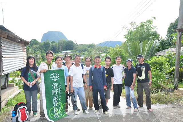
The Kuching Adventure Team

Cheers,
Wilson
Mother nature is amazing!!!

Borneo Highland Resort, Batu Panggah, Penrissen Summit Trail. Post 2 of 2

Continue from the Previous Post, >> Read Post 1 of 2 read here <<
After the rest, we continue on with our journey to the summit. The weather is a big cloudy, and we might encounter rain in the evening when we descend.

DSC_01 - snail
12.22pm. From this point onward its all ascending, and along the way there are a few places which have small stream water flowing down. I found this very tiny snail which I nearly step on it.

DSC_02
12.25pm. And also there are a lot of wild orchids along the way. Sometime we even can find more than 10 different species of orchid on a tree trunk. Good sign, as it shows that the forest on my home land are still rich with flora...must cherish it. So along the way, whenever I saw any plastic bags, or bottle I will take it along with me, and throw it when I reach the resort.

DSC_03 - leech
12.45pm. Leech, live in humid/wet places. And leech is a very fragile animal, so if you ever encounter leech, it means that the place are still in a good condition. There are 4 of us, and one of my friend been bitten by leech at least 10 times. While for me, I keep on checking on my leg, if I found one, I will just pull it away. So far leech bite for today is ZERO ;) but a few time nearly got bitten like this one.

DSC_04 - jelly looking mushroom
12.55pm. Saw a rambutan look alike mushroom. I did not disturb the mushroom, but just took a picture of it.

DSC_05 - mount view
1.04pm. Yeah!!! the summit. We finally reach the summit, well that’s not tough. The student told us that there will be a lot of ladders to climb, but we did not see any ladders. I think they are bluffing. 

This is me enjoyed the view. Nice, I can see the golf court from up here, but not the Kalimantan (Indonesia) border. It must be on the other site. While we’re here, we rest, and ate some food.  And one of my friend got bitten by leech again, oh my... pity him.

DSC_06 - millipede
1.21pm. I saw one millipede, so different between a millipede and a centipedes is that millipedes have paired legs, while centipedes don't. This was told by one of the insect expert from the Borneo Highland tour guide.

DSC_07
1.37pm. Oh, the students are right...the rest stop just now its not the summit. Cause I just saw a signboard saying that the Penrissen summit is strait up :(


We take our time to reach the summit, and along the way my friends stop whenever they hear the sound of birds singing.


DSC_08 - stick looking insect
1.55pm. There are so many ladders to climb, the ladder are made from aluminium and this is to avoid corrosion. While I was in the middle of climbing the ladder, I saw this weird looking insect right in front of me. Its body colour are well blend with the green vine in front of me, its a mantis looking creature.

DSC_09- pitcher plant
2.07pm. We reach flat ground, and I can sense that we’re near to the Penrissen summit. Saw this beautiful pitcher plant along the way.

DSC_10
2.13pm. Standing L-R: Leewang, Ho Swee Ping, Front L-R: Wilson Chin (me), and Ong Fu Hong. 

Finally we’re here on the summit. The Penrissen Summit, and from my friend reading we’re on 4360 feet above sea level. And the stone in the middle is the border stone. So the Kalimantan, Indonesia border is the view on the cliff side (where Leewang and I’m at), and Kuching, Sarawak is the one which face to Ho Swee Ping, and Ong Fu Hong near the trail.


From the stone it also marked Republic Indonesia on one side, and Malaysia Sarawak on the other side. So there is no time to waste, we then quickly ascend before it rains.  

Oh ya, about the view up there, it was all covered by fog. Although I took a few pictures, but cannot see anything.
DSC_11
3.03pm. When going down, there are a lot of ladders to climb too, some are very steep. We just take it one steps at a time, and one of my friend even saw a hornbill while on our way down. But he’s so regret that he did not capture the hornbill’s picture.


Then, we saw this adorable tiny squirrel, wondering on the tree trunk. It has a fluffy tails, with white fur on its head.


DSC_12
3.25pm. We reach the ground, this is the golf course hole number 13. My legs feels numb...

DSC_13 - Kalimantan, Sarawak viewpoint
3.46pm. We then need to walk back to our car, where we park at the Kalimantan viewpoint. Remember this morning we skip the view point and head to the trail first, so now lets checkout how is the border looks like. Our neighbour country Kalimantan, Indonesia.

Panorama-borneo-highland-kalimantan-indonesia-view-point-14
So I end my post and my journey to the Borneo Highland Summit trail with this panoramic view of the Kalimantan/Sarawak border view.

More Photos I took in my journey

DSC_0352 - bamboo bridgeDSC_0356DSC_0364DSC_0366 - waterfall and pagodaDSC_0378 - waterfallDSC_0386
DSC_0402DSC_0414 - borneo highland goft courtDSC_0416DSC_0417DSC_0431DSC_0435
DSC_0440DSC_0441DSC_0444DSC_0445DSC_0453DSC_0454
DSC_0461DSC_0465Panorama-big-tree-to-Penrissen-summitDSC_0473DSC_0481 - wild fruitsDSC_0485 - spider web