Now class, today we will learn some history about the Peace Park in Labuan. Its situated near he Kampung Layang-Layang, again near to the beach.
The Peace Park was built as a memorial and renunciation of the horrors of war. It is dominated by the memorial mound which is surrounded by landscaped gardens and pavilions. Small ponds with stone bridges and park seats are all Japanese-inspired. A bronze plaque commemorating the Surrender is mounted on a stone slab near the entrance.
On September 9, 1945, the Japanese officially surrendered Labuan to the Australian. The commander of the Japanese 37th Army, Lieutenant General Masao Baba was flown to the shores of Layang-layangan Beach in the Tachikawa K154C (HICKORY). And in a small wooden shack under the shelter of the coconut trees some 50 meters South-west of the Surrender Point, the handover signing ceremony took place.
He surrendered his sword formally to Major General George Wootten, commanding officer of the Australian 9th Division, under the witness of Group Captain C.W Pearce and Squadron Leader J.S St Heaps of the Royal Australian Air Force (RAAF) in Sydney, Australia.
To show that they are genuinely sorry for the trouble their forefathers have caused, the Japanese decided to build the Peace Park next to the Surrender Point. The Peace Park pays tribute to the ones who have sacrificed their lives in Borneo during WWII. It is also a memento of friendship between Malaysia and Japan, and a promise of peace and harmony for all mankind that such war-like cruelty will not happen again in the future.
The Peace Park was heavily funded by the Japan Shipbuilding Industry Foundation, chaired by Ryoishi Sasagawa, as well as by families of the dead and comrades in arm from some industrial firms. On April 14, 1984, Mitsunori Ueki of the South Pacific Memorial Association Incorporation in Japan handed over the Peace Park ceremonially to the Sabah Chief Minister, Datuk Harris Salleh. Till this day, funding still comes in abundantly from Japan to keep the Peace Park in good shape.
With serene waters under arched bridges and around shaded gazebos that embrace the large raised mound with two outstanding curved walls that is the centre of attention in the Peace Park. At the entrance of the Park stood a distinguishable stone slab, and on it carved clearly to echo till the end of time – “Peace is the best”.
I visited the University of Sabah before when I was travel to Sabah. And this is another University of Sabah, the Labuan Campus.
The top Photogapher. Wilson Chin
Was expecting to be able to see some young university girls, but very disappointingly no students are around that time... silly me, its almost Chinese New Year that time, so I guess most of the students are back for the holiday already.
I asked the guide if I allow to take picture, so they only allow me to take the pictures at the hall, and I'm not allow to go further up as well. So not much interesting thing happen here.
I then continue on with my journey, and next stop is to the peace park, where we can learn some history about the Labuan island.
The Labuan island surrounded by beaches, and I just follow the map, and visited most of the famous one. And also visited some which is not mark in the map. One thing good about riding the scooter is that I can go into any turns I want easily.
I didn't realize the weather is hot, not until I felt something is burning on my both arms. And by the time I knew, I got this sunburn on my arms already.
Jalan Kiamsam, The Labuan Crude Oil Terminal
I am riding down the Oil And Gas industry zone, this is at the south of Labuan island. The Labuan Grude Oil Terminal is there, not much to see there expect the building for the O&G industries. One my way out of that area, I saw this small road which lead to the beach, so I ride in. Saw another bike parked there, after 5 mins the owner came back. We say hello to each other, and the guy told me he was taking a dump there, and now he want to go back to work already...hmmm, its good that he told me that, and I'll try to watch my steps.
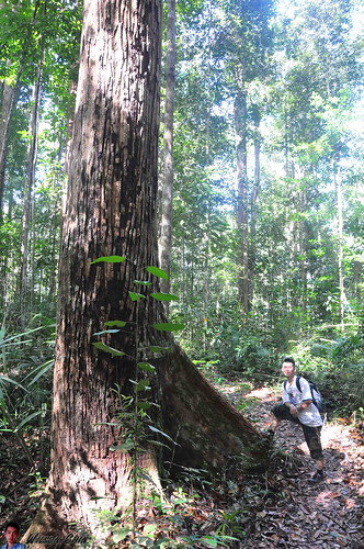
The University Malaysia of Sabah, Labuan Campus
That building is the University Malaysia Sabah, the Labuan Campus. Opposite the university they have this beautiful beach with blue and clear sea water. The strong breeze keep on blowing towards me while I rest there, and my face are cover by sand. There are also rest stop which they build under the pine tree.
I remember back when I was a kid, we have a pine tree at the back of our house. My brothers and I sometime will collect the dry leave of the pine tree and burn it. It was fun back then...
Jalan Sungai Lada, Taman Anggun.
This is another beach which is not mark on the map, as I was riding along this village, saw a lane which lead to a beach, so I went in.
This is my favorite spot among the others which I visited, I saw there is a big tree, and a swing is tie on the tree branch. The fishing boat parked next to the swing, and there is a chop tree which now serves as a small table. I sit at the swing there, and enjoy the windy breeze. The breeze are blowing gently on my face, and I don't feel hot at all as I'm shaded by the trees.
This is the life, a beautiful hangout place just a few steps away from your house. You can come here to enjoy the sunset everyday, take pictures. At night, can come here to watch the starts with your friends and family. I want a place like this!!!
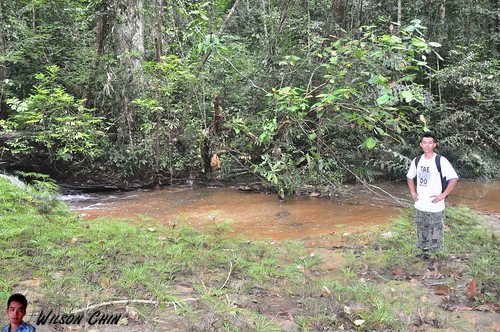
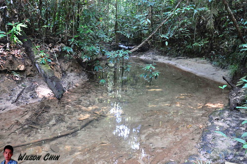
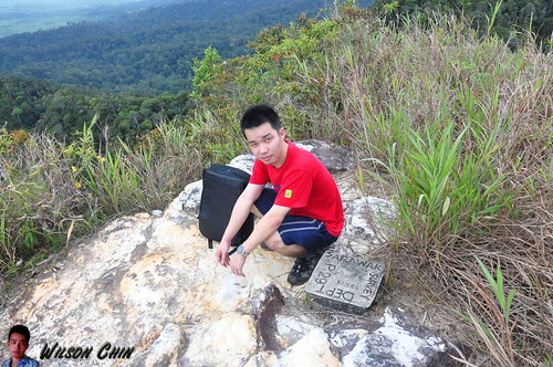
The Layang Layang Beach, at the Peace Park
There is a park called the Peace Park, this place was built as a memorial and renunciation of the horrors of war. It is dominated by the memorial mound which is surrounded by landscaped gardens and pavilions. On September 9, 1945, the Japanese officially surrendered Labuan to the Australian.
To show that they are genuinely sorry for the trouble their forefathers have caused, the Japanese decided to build the Peace Park next to the Surrender Point. The Peace Park pays tribute to the ones who have sacrificed their lives in Borneo during WWII. It is also a memento of friendship between Malaysia and Japan, and a promise of peace and harmony for all mankind that such war-like cruelty will not happen again in the future.
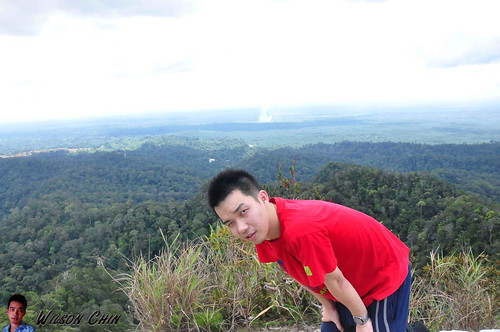
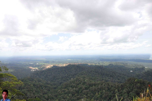
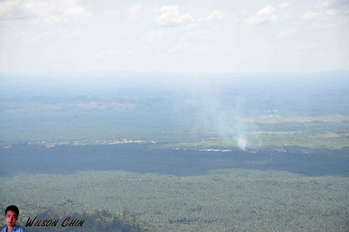
It was really hot that time, I just took some picture on the park, and then look for a tree shade, and hide under it. So the pictures above is the scene that I saw during my visit. There is a fresh water river which link to the sea, and a few fisherman boat dock there.
Something which interest me is that on the ship deck, they numbers each of the deck wood which I don't know why, and have no one to ask. If you happen to know why they do so, please leave a comment below. Thanks ;)
The Batu Manikar Beach, at Jalan Pancur Hitam
To conclude my beach tour in Labuan, I went to this UN '08 Beach, the Batu Manikar Beach. The sunset was around 6.35pm that day. While waiting for the sun to set, I bought some fried banana at the Malay stall to eat. Saw a puppy was running on the sand, and roll its body on the sand.
Tried to lured the dog with my food, but it didn't fell for it...damn!!!
Not much people here, I guess they must have too many choices here... tsk tsk, not like back in Kuching we have limited choices. There are a lot of seaweed been sweep on shore, I tried to look for jellyfish or starfish but can't find any.
I like to go to the beach very much, it clams me down when listening to the wave, and enjoying the windy breeze. Hope that one day I can come back here again.
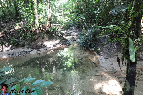
When I checked back the Labuan map, I notice this maybe is the only place where they have fresh water. The name of the river is called the Kinta Benua River (Sungai Kinta Benua). And there is a restaurant on the riverbank, from the look of it, not much people will come to a place like this. Nothing special, no special attraction, only river and trees.
I walk closer to the riverbank, and saw two guys there fishing. I went closer and chat with them, they told me that they are there since morning. And one of he guy also showed me his catch, and it was a big white fish. They called is Siakap fish.
Then I bid good bye and continue my journey. In this area it has a vast of high land, and the people here plant a lots of fruits and vegetables. I stop by at one of the stall, that stall is a place where they will collect all the vegetables from the people there, and sell it. Its somehow related to the agriculture department of Labuan. I saw they have this deep fried banana, and Malay kuih. I then realise I haven't eat anything since this morning, so that's consider as my lunch.
Start my journey again as I then proceed to the west side of the Labuan island, and there will be a long stretch of beaches to see. So see ya..
When I start ride my backpack scoter around, one thing that I notice its this small island has quite a number of Chinese temple.
The Chinese temple opposite the backpack hotel that I stayed, this is the “guang fu gong” a direct translation will be huge wealth palace 广福宫.
Then I came to this Guan Yin Pusa Association “观音寺” (Buddha of mercy) the guy in the picture is the person who look after the temple. This temple is on top of a higher ground, and I saw a huge lizard at the back of the temple where the bushes are.
This Chinese temple is called the “清水祖师” a direct translation will be the Shimizu Patriarch. What unique about this temple is that it has a very huge pillar outside, and on top of the pillar it’s the Buddha of mercy.
This is a huge Chinese temple, with a total of 3 stories. When I’m there, the people there are busying hanging the red lantern for Chinese New Year. For this place, what so unique about this temple is that it has a Hell Temple. The entrance will lead you down to a dark basement, and its very dark inside with just one dim bulb. On the walls it has carving on the scene when bad people go to hell, and punishment made on them. It really give me the goosebumps when I went inside.
I reach here coincidently; it’s more like I’m kinda lost my direction that time and just circling the place around. When I went into the temple, its very dark. I step out, read the sign again “Ying Fu Dian” “阴府殿” means hell palace. No wonder its dark!!! Since I can’t see anything, I just went off. And just when I’m about to leave, I saw another lizard again, another giant kick ass lizard. I saw a total of 2 lizzards in Labuan.
This is the biggest among all, and this is a Buddhist Association. Buddhism will come here and chant together, and do charities work to benefit the society.
If you browse the map, you will notice that Labuan is located near to the Borneo Island. Apparently it’s not part of either Sarawak or Sabah, but it’s the federal territory in East Malaysia. The capital for Labuan is called Victoria, and the island has a lot of oil and gas companies so to name a few like Halliburton, Carigali,
Shell, Schlumberger and etc. If you are at Limbang like me, the boat is the only way to get there.
One thing good about Labuan is that it’s a duty free island. You can get liquor, fragrance, and chocolate with a duty free price. So is cheap… a chocolate lover like me, this is heaven.
The fees now are cheaper, forth and back trip cost RM29, cause the government subsidies a part of the fees. Back then it was RM60.
The boat is a fully air-condition express boat; you can get your ticket right in front of the Limbang custom office. The depart time is 8AM, and after you get the ticket, you need to get the ticket stamps by the custom officer.
It’s a 2 hours boat trip to Labuan, and the journey starts at the Limbang river, the Limbang river are heavily polluted, and the color of the river are dark chocolate. So whoever wants a free coco drinks, you can get it here
Then, the will boat sails towards the Brunei Bay. So my dear reader, if you are running a mobile data, please makes sure that it’s temporary off. If not the roaming internet bill will eventually kill your wallet. After the Brunei Bay, only then the boat entered the South China Sea.
Around 10AM, and I’m there!!!
After all these years, I think I didn’t come back here for more than 10 years. Last time I came I’m still in secondary school, and we come here for the cheap beer and bar girls.
I then get a map from the information counter, and start to look for that Labuan Backpack hotel address. Been trying to get in touch with them online, but fail to do so.
I also rented a scoter to roam around the island, so let the adventure begins :D
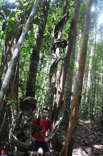
I’ve climbs quite a lot of mounts in Kuching, like the Santubong, Matang, Sentah, Gading, Singai, and etc. Some of the mount was really challenging when going up to the summit, but non of the mounts are as tough as the Lambir Mount. By far that’s the toughest one I’ve ever climb!!!
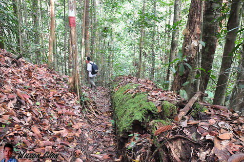
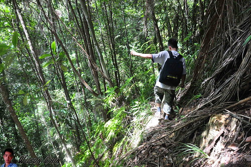
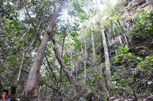
When we go hiking on mountain trails, normally its just ascend, then descend. But if your at Lambir, its not consistent, you may ascend at start, then descend until the foot hill, then have to ascend again. Just when we tough its flat trail ahead, it surprise us with some hidden trails, some rope climb, some river crossing, or ascend a steep and long trail.
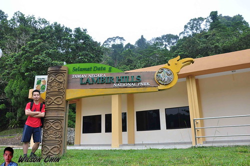
I was at Lambir Hills National Park on the start of Feb 2013, that’s just when my long Chinese New Year Holiday started. It’s a place that I always want to visit, so I asked my younger brother “Jye” to come along. He likes jungle trekking like me, so both of us make the perfect team.
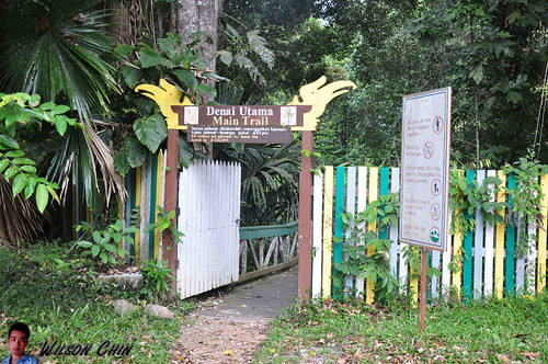
We started our journey at around 7.15AM from Miri town, and it took us nearly ½ hour drive to reach the Lambir National Park. We paid RM10 each for the entrance fees, and off we go. Here I would like to highlight about the entrance, there are two. One it’s at the back of the hostel (1.5 KM to a checkpoint), and another one it’s at the main entrance at the front of the park HQ (2.2 KM to the same checkpoint).
The differences are 0.7 KM, but this can save you a roughly one hour of very tough walking distant. My brother and I don’t know about the short route, so we just ascend by using the main entrance.
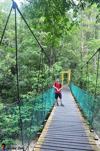
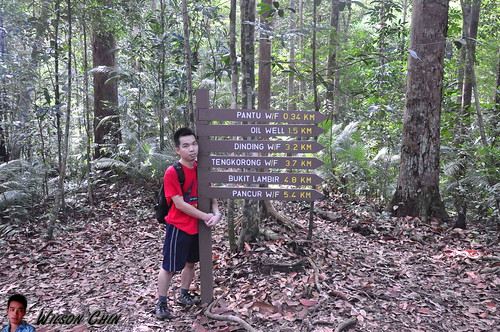
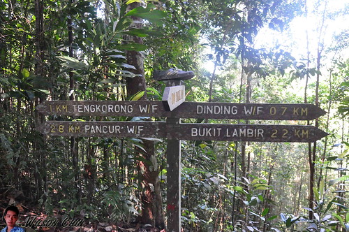
Upon entering, we’re welcome by a bridge, which link us to the other side of the hill. At first it was still an enjoyable walk, I lead and my brother follow. At the Lambir park, there are 7 - 8 recorded waterfall. Along the way there are also lots of small waterfalls which are not recorded in the map.
Then we reach a suspension bridge, and just not far from the suspension bridge we reach the first waterfall. We stop by for a while to take some photos and video, our goal is to reach the Lambir Mount summit. So off we go after a short break.
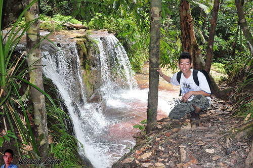
Along the way, we encounter two waterfall, they have no names. On the map they only marks as Waterfall 1, and Waterfall 2.
After that, we need to hike up on the concrete staircase, and then we reach another waterfall. There are no signboard on it, so not sure what is the name. Then, we pass the famous Latak Waterfall, to save time, we did not visit Latak waterfall. I told Jye that we just come back next time for this waterfall.
The Latak waterfall it’s the most visited waterfall in Lambir Park here, the water is clear, and cozy I can see why people like it here.
Jye are quite happy, as he keep on stopping and ask me to take picture of him on various wired stuff along our way.
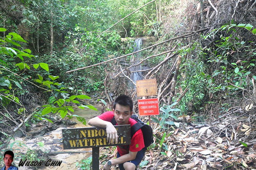
Till a wooden old bridge onward, we start to feel tired. We walk slowly to conserve our energy, and after 30 mins, we reach a junction one is to the Lambil mount, another one to the Nibong waterfall about 100m. We visited the Nibong waterfall, and took some picture, the trail to the waterfall are muddy.
On one of the stop we saw 3 park rangers repairing the damage rest stop. I asked them how far it is to reach the Lambir Mount summit, and the respond they gave are quite shocking! They advice us to hike the short trail which is to the Pantu Hill, roughly about 2 hour. If we were to go to Lambir Hill, it will take us around 5 – 6 hours.
Then I look at my brother, with my eyes open wide. 5 – 6 hours, are you kidding me??!! So they guys said if we hurry, we might be able to reach back the park HQ on time, which is around 6pm.
So we proceed on, I told Jye that we’re here for the highest mount, not some easy 2 hour Pantu Hill trail. If we miss out this chance, we’re not sure when will we come back here again.
We bid farewell to the rangers, they also wish us good luck, and asked us to be careful cause is been a while since there are people climb the Lambir mount, the trail now are in their worst condition, no maintenance work had been carry out for long time.
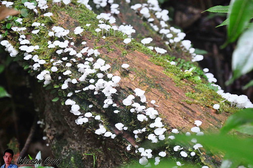
When we’re crossing an old wooden bridge, one of the handle was full of tinny white fungus. I told my brother that this can be eaten, and he fell for it… what an idiot K
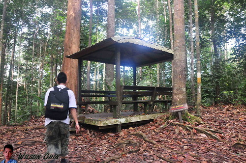
We’re been walking for almost an hour, and was really tired. Luckily we reach a rest stop. We quickly sit down and rest. We can't drink too much, because both of us just bring one a liter water each.
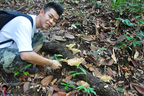
I keep track of our time tightly, so we just took a short 5 minutes rest to catch our breath. And off we go again. Along the way, I start to explain to Jye on the various flora that we encounter.
We saw this brown fungus, and on the top it carries some water. I use my finger to dip on the water, and pretend that I link my finger to taste the water. Then I told Jye to try it too, that stupid kid actually fell for it again. K
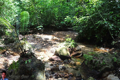
Dear readers, here I would like to informed you that to reach to the summit of the Lambir Mount. You need to cross three river like this with no Bridge!!! Yeah, no bridge. You can either take off your sport shoes, or like us we cross by using the falling tree branch (watch my video on how we cross the river).
There are paint indication on the trees opposite the river, so that's where we need to go. We only notice this after scouting the place several minutes. Jye lead the way, at first there are two tree branches, when Jye try to cross the first one, it broke into half. And all the ants inside the branch fell into the water, then we saw the fishes start to swim near the falling branch, and eat the ants.
Jye tried again by using the second one, and he’s able to do so. But need to be very careful, the branch are slippery, we might fall into the river if we lost our balance.
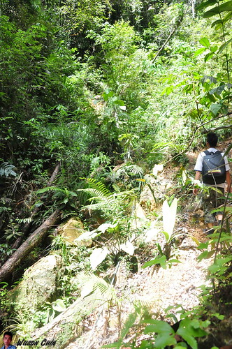
Off we go again!!! We have been on the trail for 3 hours. In our mind, we only wish that we can reach the summit fast. We also lost count on how many hill that we climb, and how many have we descend.
This is another river which don’t have any bridge. The trail are poorly maintain, I would say no maintenance at all. When we reach here, its very difficult for us to find where to next??!! So it took us quite some time to look for the next tree marking for direction.
I couldn't tell you how happy we are when we saw this. It proved that we are on the right trail, and in the same time it also tell us that we still have 2.2KM to go….. so far we’ve been hiking for almost three hours. We only dare to drink a small amount of water each time we rest.
Jye told me that he’s hungry, I replied him that we cannot eat the food yet. Cause we bring sausage, fried chicken, and more sausages. All these food are salty, and it will only make him thirstier. Frankly speaking, I also didn’t expect this, I only tough that it will be a walk in the park, so this time I did not bring any sweets, chocolate, energy drinks, or extra drinking water.
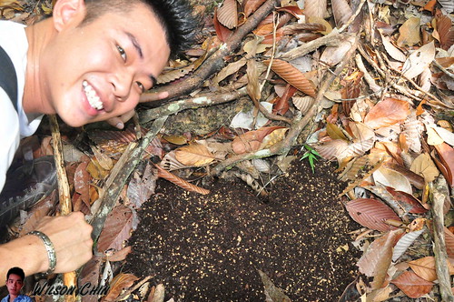
And then we saw these giant ant nets. I told Jye, ants have high protein, so if he is hungry, he can eat the ants first.. tsk tsk…
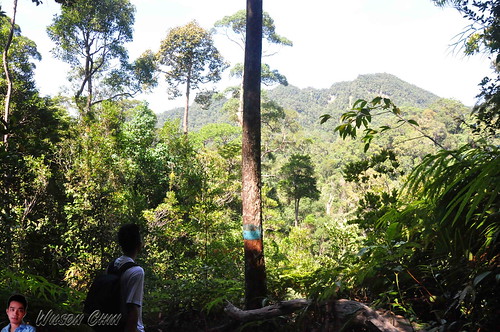
Look at this picture; we are not looking at the tree in front of us. But we are looking at the mount far in front of us. That’s where we are going, and that’s still a longgggggg way to go. Now I start to ask Jye why do we paid money to come here to suffer…hahaha :D
The time now is 11.30am. we still very far away from the summit, and I’m start to get worry that we might don’t have enough time to descend. Here is another place which have no clear direction marking. We have spend quite some time here looking around for the marking on the trees. And we’re just going circle in that area.
I remember when I hike the Rayu Trail at Matang, I also saw this kind of tree too. And the way that it circle the tree are more or less the same.
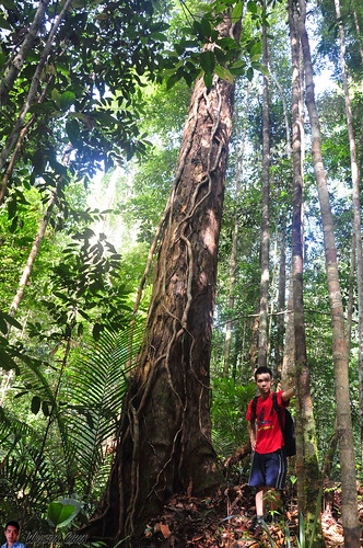
From this point onward, it starts to get really tough. There are lots of steep wall to climb, some we even need to use the rope to help us climb up. I am really tired, barely can walk another step again. But I want to reach the summit, so I did what I normally do when I’m tired, just force myself to walk one step forward, follow by another, then another…. with very slow speed. This actually works, remember your goal in the first place, and never turn back.
The trail are … well I would say that it don’t have any clear path to walk. The trees and grass has cover the trail, and its really hard for us to walk. There are very sharp leaves along the way, we don’t have knife with us. I blame this to Jye, as I already remind him so many time to bring the knife, but in the end he still forgot.
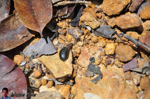
Yeah, wet and humid place like this with almost no pollution, there will be this cute little thing. The leeches!!! I got a few bites on my ankle, and toe. Same goes to Jye, and this is his first time got bitten by leeches, so its quite a good experience for him. Look at this fat leeches, sucking Jye's blood, now with a fat belly.
I constantly ask him to check on his shoes, to make sure that no leech trap on his feet, and mine too.
I got so tires, that I cannot take any more pictures, the both of us just walk up, we also stop talking to each other for about 45 mintues, so there are a 45 minutes of photos gap. I have no more energy to lift my bulky Nikon, and took picture, or make any video.
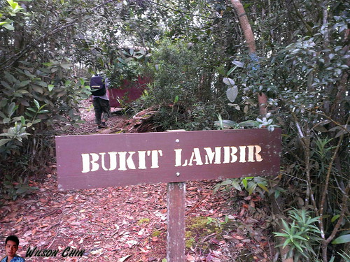
The time now its 12.40pm, and we finally saw this sign saying “Bukit Lambir” (Lambir Mount). Its been near to 5 hours from the park HQ this morning, and we finally made it!!! hurray!!!
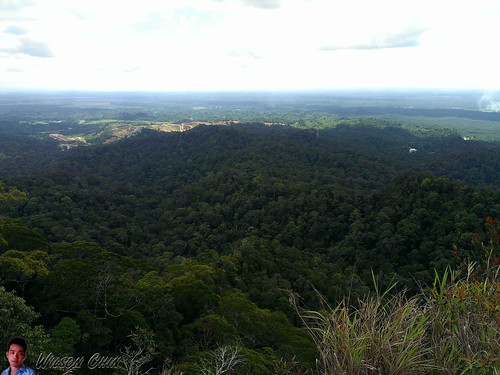
The view on the very top of the Mount Lambir, this is what we come here for! This is what we want! This is it!
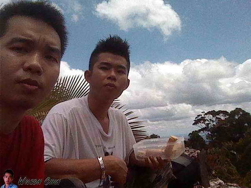
Me and Jye and the Lambir Summit as our background, Jye got so hungry I ask him to eat my share of the lunch.
Its very windy up there, on the summit, there is a concrete mark state that this mount had been measure by the Sarawak Survey Department. I’m so happy that the sky is clear, I took a lot of panoramic picture on top. And I made it!!!
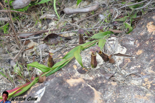
The usual plants that I saw on the summit are pitcher plant. I can say almost every mount summit that I’ve been to, there are pitcher plants there. And here at Lambir, they have the mini pitcher plant.
========================
After the Climb
So there you have it my friend, the story of me and my younger brother Jye concurring the Lambir Mount. We use 5 hours to reach to the top, and when we descend, we have to go through the thing we encounter before.
We also finished our water, and I just drank the water on the stream, cause I saw its clear. Jye also do it when he saw me drinking it.
The feeling when descending, is that I cannot feel my legs at all and I even feel tired when walk on flat surface. We walk very very slow, and took a lot of rest every 10 to 15 mins.
We manage to reach the park HQ at around 5pm, and the first thing that we do its buy two 1.5 liter of water at the canteen and finish it off in one go.
The next day, and the day after that both of our legs are still pain. It took us almost 4 days to recover. But we’re glad that we reach the summit.
=========================
Facts about Lambir National Park
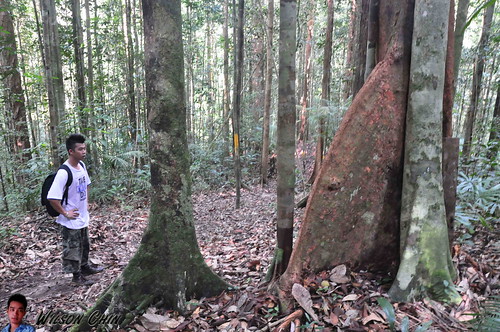
Lambir Hills National Park is 30 kilometres (19 mi) south of Miri in Sarawak, Malaysia, on the island of Borneo. It is a small park, at 6,952 hectares (17,180 acres), and is composed largely of mixed dipterocarp forest, with some small areas of 'kerangas' (heath forest). The park is 150–465 m (490–1,526 ft) above sea level.
Lambir Hills National Park is probably the world’s most complex and diverse forest eco-system. Experts have found what appears to be the greatest level of plant biodiversity on the planet. It is not only plant life that is diverse and plentiful at Lambir - 237 different species of birds (at the last count), flying squirrels, wild pigs, gibbons, many different types of monkey, various species of deer, and untold insects and other invertebrates, all combine to create Lambir’s rich biological kaleidoscope.